Les Platières
From one combe to another, farms and lodges are scattered across les Platières, the little roof of the Jura. From its many viewpoints, the High Jura Mountain Range and Bellecombe lazily unfold, marked by the crêt de Chalam much like an exclamation point!
7 points of interest
L'habitat dispersé - Gilles Prost - PNRHJ History & HeritageDispersed habitat
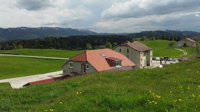
The habitat in the High-Combes is a result of the late clearing having been carried out during the 13th and 14th centuries, and later still during the 16th and 17th centuries. Land was leased by the Saint-Claude abbey in long strips running perpendicular to the combe in which each family could live self-sufficiently. The bottom of the combe served as prairies and hay fields, its immediate surroundings were reserved for grain farming, and the ridge was reserved for fire and craft wood and for pastures.
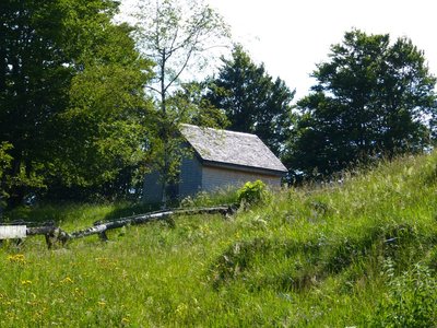
Grenier fort - Gilles Prost - PNRHJ History & Heritage“Grenier fort” (strong attic)
Born from the ingenuity of master carpenters, “strong attics”, like the one overlooking the house to your left, is also a testament to the High-Jura’s memory. Both a pantry and a safe, these attics contained grain, food and seeds, as well as a wardrobe, precious objects, tools, writings and essential goods, protected from fire and far from greedy eyes. Its walls are often adorned with crop accounting records, climate calendars and family events. Would you like to visit a strong attic? Head to the Maison du Parc in Lajoux.
 Fauna
FaunaThe alpine newt
Although it spends half the year on land, this amphibian also needs the shallow waters of ponds and ruts to reproduce and lay its eggs. During its land phase, the alpine newt only leaves its hiding place at night, slowly crawling on the ground in search of food. However, during its aquatic phase, it doesn’t hesitate to move around and feed, sometimes during the middle of the day. The alpine newt is a good swimmer and can spend several minutes holding its breath in cold water. You will recognise it by its characteristic bright-orange underbelly.
- Geology
Sinkholes
Notice the two small depressions in the middle of the field to your right. These circular depressions, which are usually larger than they are deep, are sinkholes. They expose the karstic soil below due to a dissolution of the rock underneath. They are created by fractures in the limestone, which become larger due to dissolution and drainage. They are often found in places where limestone has fallen victim to significant cracking, along fault lines and anticline summits, as is the case here.
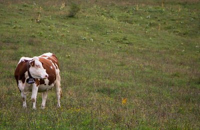
Montbéliarde - Nina Verjus - PNRHJ Pastoralism and agricultureAn unsuspecting artist: The Montbeliarde cow
If not for this cow, with a beautiful white and red-speckled coat, these landscapes would not be what they are: vast spaces devoted to pastures, scattered here and there with farms, long dry-stone walls and spinneys. Without this cow, the cheese would not be as famous as it is either! Their milk alone allows for the local production of protected designation of origin cheeses such as comté, the bleu de Gex and morbier.
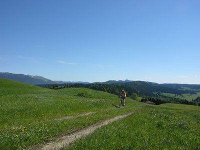
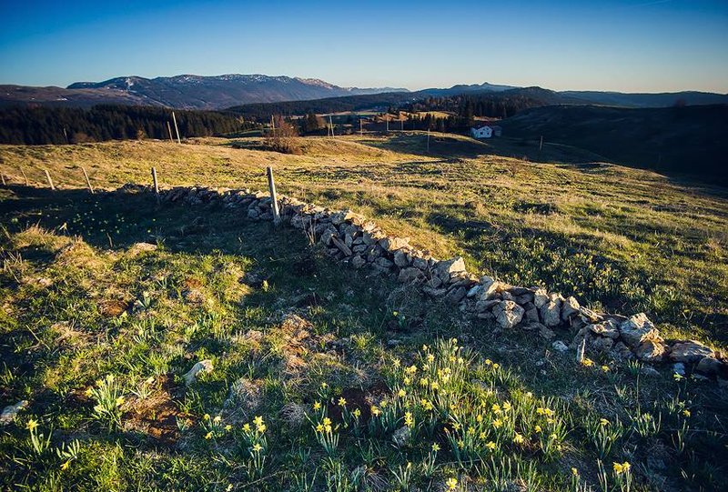
Point de vue des Platières - Gilles Prost - PNRHJ ViewpointViewpoint from les Plâtières
From this little roof above the Jura region, you can admire the High-Jura mountain range, Bellecombe and its large grazing areas. From east to south, you can see the Montrond, the Colomby de Gex and its twin, the Crêt de la Neige, and lastly the pyramid of the Reculet. Following the line of les Plâtières, to the south-west, the triangle made by the Crêt de Chalam is unmissable.
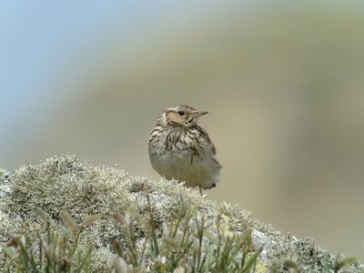
L'Alouette lulu - Fabrice Croset FaunaThe woodlark
Lu,lu,lu,lu,lu,lu … lu,lu,lu,lu,lu,lu... We’re sure you can guess why its Latin name is Lullula arborea. Yes, it’s named after that shrill, monotonous call that it makes whilst flying over low-cut lawns on a beautiful spring day. This is likely the only chance you have of seeing this bird that is extremely discreet when on the ground.
Description
On the corner of the stopover gite AUX MOLUNES - LA VIE NEUVE, the trail starts on the path (yellow waymarking) along the hay fields towards les Granges. Staying on this path, head past a small ridge to your left and gradually descend. The path cuts through a small forest and opens onto a meadow.
Take the grassy path that is more or less marked out descending along the ridge to the right. (Note to your left a former farm with a granary). Cut through a forest and exit onto a small road. Follow this road to the left to les Granges.
The road to your right will take you to the houses in Laisia.
A stone path ascends to the right towards les Platières. Bordered by ashes, it quickly ascends and opens out onto the combe at the summit. Cross this combe and head back down, opposite your, through the woods, to the hamlet of Les Platières.
Take the very stony path to your left into the forest (white and red waymarking). Head to an open combe and follow a trail to your left into the pasture of Les Platières (cycling path). Go past a small lodge, down into a pasture to your right (cycling path) and reach the west ridge. Follow an old, little marked, path to the left of the valley that will take you to the crossroads in Cariche.
The path (two cycling paths), descends through the meadows and heads up to a beautiful farm. Heads back downhill via a stone path to your left. You will come to a road, which you will follow to return to your starting point.
- Departure : Town hall parking lot in the hamlet of La Vie Neuve
- Arrival : Town hall parking lot in the hamlet of La Vie Neuve
- Towns crossed : Septmoncel Les Molunes
Forecast
Recommandations
This trail passes through pastures with livestock and forest paths. To respect the owners and farmers granting you passage, and for the security of livestock and wild fauna, we ask that you remain on the waymarked paths. Use the adapted passageways to get across fencing and be sure to close gateways behind you.
Please keep your dog on a lead if you have one.
Wild flowers are beautiful, they may be rare and protected and often wilt quickly. Do not pick them! They will delight the next hikers.
In case of forest works (felling, skidding, etc.), for your safety, know when to stop and turn around.
Information desks

Tourist information centre - Haut-Jura Saint-Claude
3 place de l'Abbaye, 39200 Saint-Claude
Transport
To visit and get about in the High-Jura, visit www.reshaut-jura.fr, the eco-mobility portal listing all means of transport within the Park.
Access and parking
25 km from Saint Claude, via the D 436 until l’Évalide, followed by the D 25 to La Cernaise, and lastly, the D 292 E1 via Les Rasses and le Petit Crêt de Let, to reach la Vie Neuve des Molunes.
Parking :
Report a problem or an error
If you have found an error on this page or if you have noticed any problems during your hike, please report them to us here: