The Crêt de la Vigoureuse
Imagine the Jura: an immense stairway whose three plateaux form vast steps up to the High-Jura. It is as though the mountains are stretching to see their giant cousins in the Alps, on the other side of Lake Geneva. A stunning view also awaits you from the High Jura Mountain Range, one of the most representative marks at the heart of the High-Jura Park.
23 points of interest

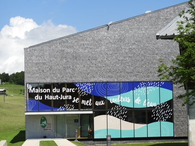
La Maison du Parc - Patricia Louvrier - PNRHJ History & HeritageThe Maison du Parc
The Maison du Parc, which serves as head office for the High-Jura Regional Natural Park, has remarkable architecture and shingled facades. It offers visitors a chance to discover the region through exhibits, projections and a tour of a “Grenier-fort” (a strong attic). The exhibit takes visitors through each of the aspects of the High-Jura, in a colourful, modern and interactive setting: landscapes, nature, craftsmanship and industries, tourism, agriculture and forestry. An acoustic stroll offers an unexpected, poetic and vivid opportunity to submerge oneself into nature in the High-Jura through its exceptional sounds. Finally, two remarkable and recent films on landscapes complete and illustrate the visit: one on the geology of the Jura massif and the other on peat bogs.
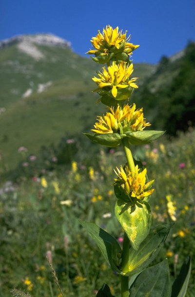
Gentiane Jaune - Jean-Claude Marchand FloraIn the middle of the flowers, the great yellow gentian
Typical of these environments, the great yellow gentian will be by your side every step of this hike. A fun fact: if you squash the gentian’s fruit between your fingers, do you recognise the smell? It smells of peas.
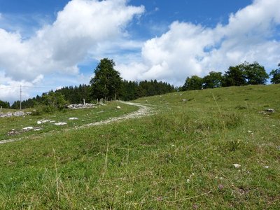
Route Royale, Route du sel - Gilles Prost - PNRHJ History & HeritageRoute Royale (Royal Road), Route du Sel (Salt Road)
The road you are on is called “Route Royale” (Royal Road) or “Route du Sel” (Salt Road), which once linked Saint-Claude to Geneva via Mijoux and Gex. At the time, the Jura would sell salt from Lons-le-Saunier to Switzerland. The road was built in 1742 by “corvées”: taxes paid in days of work.
The narrow “Route Royale” was deemed too dangerous due to its short steep bends and was replaced during the early 20th century by the current road between Lajoux and the La Faucille pass.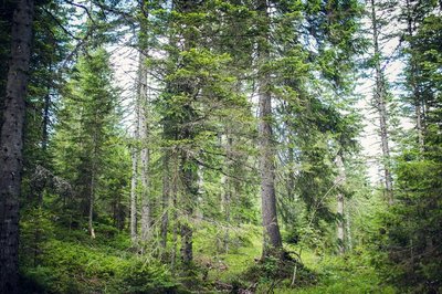
La futaie jardinée - Léo Poudré - PNRHJ Know-howSelection forests
How beautiful and natural are the High-Jura forests? Did we say natural? Well not entirely: they bear the mark of Man, who has exploited these lands for centuries. Here, forests are “managed”: mature trees are harvested first, a diverse range of species and ages are preserved and the forest regenerates by itself. Local knowledge is used to serve a diverse range of wood activities (carpentry, construction, cheese boxes, shingles, toys, firewood, etc.).
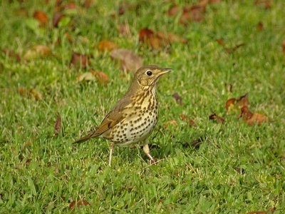
La Grive musicienne - Gilles Prost - PNRHJ FaunaThe song thrush
There’s no approaching a forest on a spring morning without hearing the song thrush. Its loud chant is essentially based on short musical patterns that it repeats two or three times. It builds its nests in forked branches.
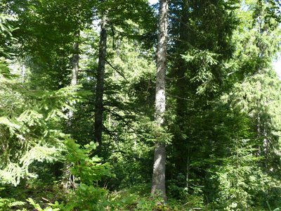
La forêt d'altitude - Gilles Prost - PNRHJ Natural environmentsHigh forests
Here, you are at an altitude of 1200 metres. Altitude decides which trees are found in the forest, based on each species’ preference. The two main coniferous trees in this forest are the spruce and the pine tree. A few small details set these trees apart. Can you tell which is which? The spruce has brown bark and round needles, whilst the pine tree has a greyer trunk with flat and vivid green needles.
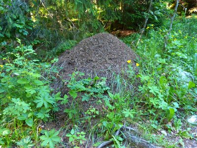
Fourmillière - Gilles Prost - PNRHJ FaunaThousands of interrelated species
Red ant nests are easy to spot in this clearing. It is said that up to 2000 insect species can live in these nests. Some use the ant nest without causing any damage, whilst others are parasites. This mound of twigs also serves as a pantry to the black woodpecker who feeds on ants. This same bird bores holes into tree trunks in the search of larvae. When these holes are abandoned by the woodpecker, the boreal owl uses them as a temporary home.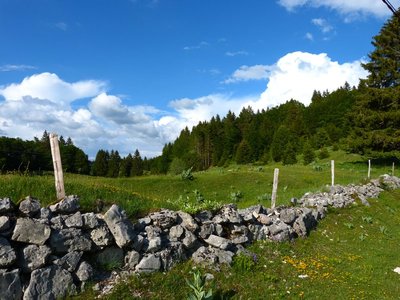
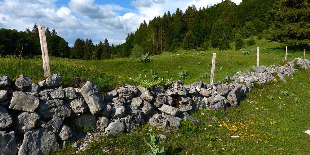
Les murets en pierres sèches - Gilles Prost - PNRHJ History & HeritageLow dry-stone walls
Low dry-stone walls have outlined Jura landscapes for centuries. They set out the limits for plots of land, mark the frontier between France and Switzerland, border hay fields or vegetable plots and flank the “vies” (lanes). Built without any binding agent, these dry-stone walls are constructed according to ancestral building practices. Now typical features of these landscapes, they are also home to a remarkably diverse fauna and flora.
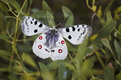
L'Apollon - FaunaThe Apollo, an iconic guest in these lawns
No Greek gods in this area, but rather a rare and protected butterfly that flits from flower to flower on High-Jura lawns. The caterpillar develops on stonecrops (small succulent plants) and transforms into a fabulous white-winged butterfly with red spots. Although the Apollo is shy, you may be able to see one atop knapweeds or umbellifers. Keep your eyes peeled!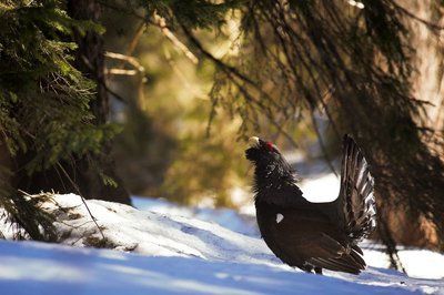
Le grand Tétras - Léo Poudré - PNRHJ FaunaAn order protecting the western capercaillie
Here, you are at Pièce d’Aval. To the north is most of the Massacre Forest, which is home to the western capercaillie.
Today, due to the species’ strong decline in numbers, it is protected by an APPB biotope protection order, which regulates all types of travel in the Massacre forest (on foot, on skis, by car). Thus, the western capercaillie is protected during two particularly sensitive periods of its life: winter and mating season.
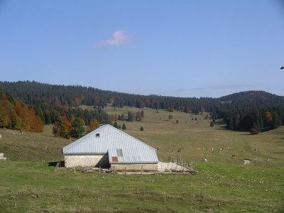
Chalet de la Pièce d'Aval - History & HeritageMassacre forest and Geneva
Massacre forest (“forêt du Massacre”) is named after one of the war episodes having occurred between the 13th and the 18th century and which opposed the Bernese, the Vaudois, the Savoyards and the French in their desire to govern Geneva. During the 16th century, Geneva became an important European trade centre, at the expense of Lyon, Chalon-Sur-Saône and Dijon. At the time, Bern was attempting to introduce Protestantism to Geneva, and the Savoie wanted to claim this strategic city for itself. In 1535, Francis I, who was then an ally to the Bernese, decided to send a division of one thousand Italian mercenaries to defend the city. When heading back up the Valserine valley to cross over the Faucille pass, his troops were blocked of by the Duke of Savoie’s army. They were pushed back into the Mountain forests just above Lajoux, and his soldiers were wiped out by the Savoyards’ axes.
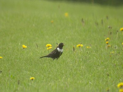
Le Merle à plastron - Fabrice Croset FaunaThe ring ouzel
This large member of the thrush family with a white neck lives in high-altitude areas and appears to be suffering from climate change. Its numbers are dwindling. However, a study of its migration patterns is also showing that this bird is having more and more difficulty in finding food during the winter in North Africa, as the junipers that it feeds on there are being cut to heat villages.

La Fourmi des bois - Gilles Prost - PNRHJ FaunaThe red wood ant
On a walk through the forest, you will surely come across mounds of twigs created by red wood ants. Ant nests are built like actual cities and are home to several hundreds of thousands of individuals all organised to ensure their survival and their development. Although they feed in part on the honeydew left by aphids on spruces, they also regulate “pest” insects in the forest by eating them. This is why they are protected and must be respected. They don’t have many natural predators, only black woodpeckers and badgers.
La forêt Jurassienne - Natural environmentsThe Jura forest
The Jura forest is mainly comprised of beech, spruce and fir trees, all of which have very different root systems: the roots of fir trees consist of a taproot (roots that are buried deep underground pointing downwards), beech and spruce trees have flat roots (roots that follow along the ground), while pine trees have heart roots (roots that dig into the ground and spread out along the surface). These trees grow in mountainous climates (harsh climates). They are built to resist the cold and if the climate becomes too warm, some trees like the spruce may not survive.
Erine and Neyssa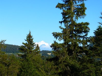
Point de vue du crêt de la Vigoureuse - Gilles Prost - PNRHJ ViewpointViewpoint from the Crêt de la Vigoureuse
This summit, whilst discreet, is actually an ideal place to admire the landscape offered by the High-Jura mountain range and the High-Combes punctuated by the Crêt de Chalam. When the weather is nice, by moving a few metres between the low wall passage and the summit, visitors can see the Mont Blanc shining in the dip created by the Faucille Pass.

La chaîne du Jura - GeologyThe Jura mountain range
The Jura is a mountain range comprised of plateaus. It formed millions of years ago thanks to the Alps mountains. It all started with tectonic plates which came together and pushed very hard against each other. After a while, these plates pushed upwards to form the Alps, while the Jura folded. The Jura takes its name from the well-known age of dinosaurs: the Jurassic period. We must remember that the sea was once here. Thanks to the dead animals that lying at the bottom, sediment formed. This is why there is a lot of limestone and many fossils here.
Thibaut and NINO
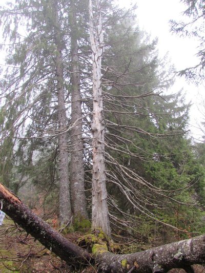
État de santé de l’arbre - FloraA tree’s health
A tree can live for several tens (or hundreds) of years if it is in good health.
However, even if it is still standing, a tree can be dead if its core is dead.
How can you tell if a tree is sick?
When a deciduous tree has yellow, brown or red leaves in the middle of the summer, compared to others which have green leaves, this can be a sign of sickness.
When a tree is dead, you can tell because it loses its bark, its leaves are the same colour as in the autumn, it can have holes or marks left by parasites such as the shot hole borer and it loses its leaves (or needles if it is a softwood tree).
Yet, dead trees aren’t problematic in the forest. Quite the opposite!
Clara and Candice
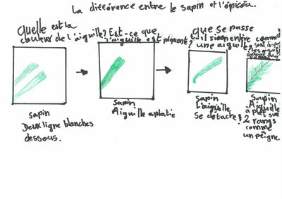
Différences entre le sapin et l’épicéa - FloraDifferences between the fir tree and the spruce
Can you tell between the fir tree and the spruce? A few pointers might help:
- The position of the cones: Spruce cones (fruit) hang, while those of the fir tree stand up straight.
-Cones on the ground or not: Spruce cones can be found on the ground, but fir cones are not as they stay standing on the branch and don’t fall off as easily.
- The colour of the bark: Spruce: brownish red and scaly, Fir-tree: grey.
- The tree’s shape: The crown of the spruce is pointed, while the fir tree’s crown is flat.
- The colour of the needles: On the spruce, the top and the bottom of the needles are the same colour, and on the fir tree, there are two white lines underneath.
-Is the needle sharp? On the spruce, the needle is pointy and sharp, while the fir tree’s needles are rounded.
- What happens if you remove a needle? On the spruce, part of the bark remains attached, while on the fir tree, the needle comes off easily.
- The needles around the sprig: on the spruce, the needles are scattered all around the sprig. The fir tree’s needles grow flat in two rows like a comb.
Olivia and Ewan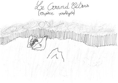
Les espèces protégées - Natural environmentsProtected species
On your way, you might come across remarkable species that are a part of the quality of the High-Jura’s biodiversity. Some of these species are protected by law, while others are not protected but are a part of our heritage and must be observed with care. We have decided to mention three species that we particularly like.
The lynx: This mammal is a carnivore. It’s like a big spotted cat with feathered ears. The lynx is a wary and discreet animal, so it’s very hard to find one. But we like to know that it’s in our forests!The western capercaillie: It’s like a big chicken with colourful feathers (brown, red, black and green). It can fly, but not for long and not very high (it can perch on trees). It is sensitive to disturbances in the winter and spring.
The orchid: There are many species of orchid. In June and July, you might come across the elder-flowered orchid on this trail. It can be either fuchsia or vanilla. Although this species isn’t protected, it’s best not to pick it, nor squash it or rip it out.
We are counting on you to protect these species, to be discreet and to not leave the trails!
Manon and Jade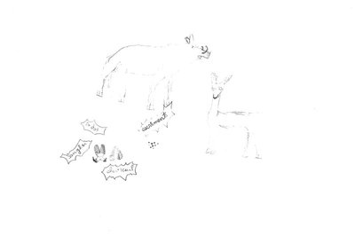
Les traces et indices: chevreuil et sanglier - FaunaTracks and clues: deer and boar
Keep your eyes peeled! You might find a few tracks and other clues on your path!
Tracks:
The boar has hooves that are over six centimetres long and the deer’s are less than six centimetres. Deer have antlers that are partly detachable bone. A boar can sometimes be detected from upturned earth in fields.Deer and boar droppings
Droppings are very useful to find animals such as deer, foxes and boar... Using a stick, we can see what the droppings are made of and learn what the animal has eaten and what animal it is.
LALIE AND SACHA V.
La fourmi et le geai - FaunaThe ant and the jay
The Eurasian Jay is a brightly coloured bird from the Corvidae family. Mainly an insectivore, it eats words, larvae, acorns and beechnuts.
The Jay has its own way of getting rid of ticks and other small insects: it lands on an anthill to frighten the ants. They then defend themselves by releasing formic acid which allows the jay to get rid of the little bugs. The jay then picks them up with its beak and places them in the anthill to feed the ants.
Maëlle and Laly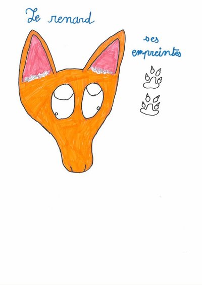
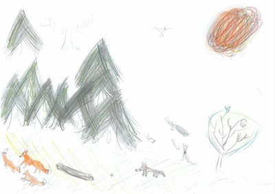
Indices : Renard , lièvre et écureuil . - FaunaClues: The fox, the hare and the squirrel.
Let’s discover local wildlife with a few clues.
If you come across small round droppings, you’ll know a hare has been here. Hares are herbivores and they take up shelter in burrows.You will know if a fox is around by its tracks, which are almost identical to a dog’s pawprint. However, the fox’s digits are spread out much wider and it walks in straight lines.
If you want to know whether there are any squirrels in the area, look at the spruce cones on the ground to see if they have been nibbled on or not.
Ellyne, Morgane and Néo .
Les vaches et le comté - Pastoralism and agricultureCows and Comté
Cows eat grass but grass alone isn’t enough.
To produce milk, they need to have a calf.
During the day, they graze. Mornings and evenings are spent in the milking parlour.
At night, the lorry from the cheese dairy picks up the milk from several farms. Early in the morning, cheesemakers curdle the milk by heating it and adding calf rennet (from the calf’s stomach) to produce Comté. The Comté’s flavour is determined by the quality of the grass.
Emy and Sacha C.
Description
From LAJOUX, the trail cuts through the village towards Mijoux (white and red waymarking), heading past the front of the Maison du Parc. At Route Royale, the road ascends steeply and reaches a pasture (cycling path). The path continues pleasantly until it reaches Trécombe.
Branch off to your left (yellow waymarking) on a forest path that is rocky, muddy and hilly. Exit through the pasture and descend the combe to the left (grassy path) for 300 m before coming to the intersection at La Pièce du Châtelain to your right.
The grassy trail heads over the low wall (cycling path) before ascending (white and red waymarking) through a pasture along the edge of the forest. Take a road (cycling path) to Sermangindre (chalet). Cross a second cycling path to follow the trail parallel to the road, across several pastures until your reach La Pièce d’Aval.
Head up the road to the left (yellow waymarking) for 300 m then take the “chemin de la Combe du Sous” to your left. Head past La Balise d’Amont before coming to Sous la Vigoureuse.
The forest trail ascends to the right into the clearing of the CRET DE LA VIGOUREUSE.
The hilly trail descends once more to your right towards Lamoura, to reach the Forest of the Vigoureuse. The stony and muddy path branches off to the left to reach the combe and the houses in Chez Gauton. The path heads right and descends back towards the village of Lajoux via Route Sur les Champs.
Return to your starting point (red and white waymarking) in LAJOUX via the road to your left.
- Departure : Lajoux
- Arrival : Lajoux
- Towns crossed : Lajoux
Forecast
Sensitive areas
Western capercaillie
- Impacted practices:
- , Land-based
- Sensitivity periods:
- JanFebMarAprMayJunDec
- Contact:
Recommandations
This trail passes through pastures with livestock and forest paths. To respect the owners and farmers granting you passage, and for the security of livestock and wild fauna, we ask that you remain on the waymarked paths. Use the adapted passageways to get across fencing and be sure to close gateways behind you.
Please keep your dog on a lead if you have one.
Wild flowers are beautiful, they may be rare and protected and often wilt quickly. Do not pick them! They will delight the next hikers.
In case of forest works (felling, skidding, etc.), for your safety, know when to stop and turn around.
Information desks

Tourist information centre - Haut-Jura Saint-Claude
3 place de l'Abbaye, 39200 Saint-Claude
Transport
To visit and get about in the High-Jura, visit www.reshaut-jura.fr, the eco-mobility portal listing all means of transport within the Park.
Access and parking
20 km east of Saint-Claude via the D 436 through Septmoncel.
Parking :
Report a problem or an error
If you have found an error on this page or if you have noticed any problems during your hike, please report them to us here: