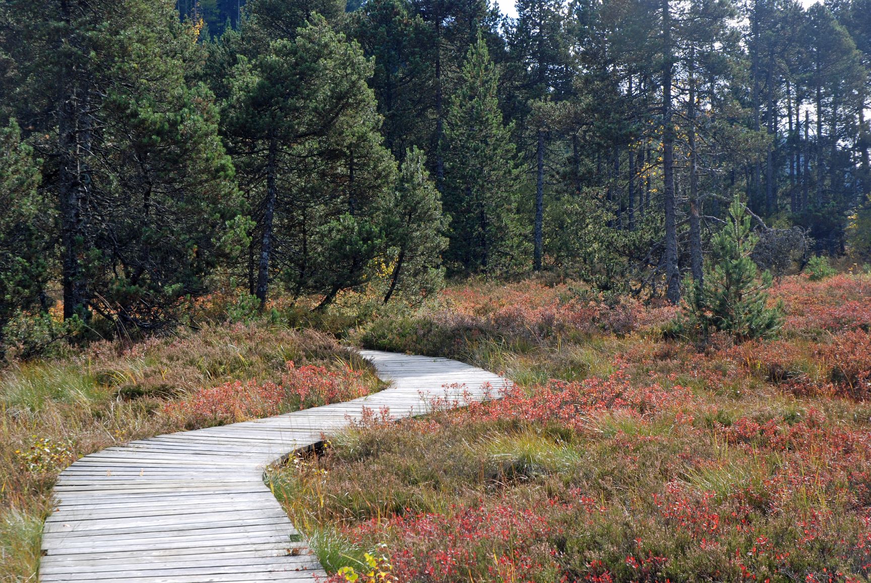
Lakes and peatbogs
Departing from Prénovel, this route crosses characteristic landscapes of the Haut-Jura: areas of pasture, forests, valleys, peat bogs and crests.
The interpretation trail of the Nanchez peat bog, a few minutes from the route, will make you discover this surprising natural environment, so precious to preserve because it is home to a rich variety of plant and animal species. The hike is enhanced by the passage to the belvederes of the Virgin and the Mill, arranged on the high points of the circuit. These belvederes will allow you to discover the peaks of the Haute Chaine du Jura and the Alps in clear weather.
This Jurassic Velo Tours route has digital guidance only. You will not find any markings on the ground. Let yourself be guided with the Jurassic Vélo Tours app, which can be downloaded for free from Google Play Store and App Store.
6 points of interest
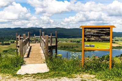
Belvédère du moulin - Nina Verjus - PNRHJ ViewpointThe Mill’s Belvedere
The Mill’s Belvedere, on the edge of the valley, offers an overview of nearly all of the Abbaye lake. From here, visitors can learn about how the landscape around the lake has evolved throughout the centuries (interpretive sign).
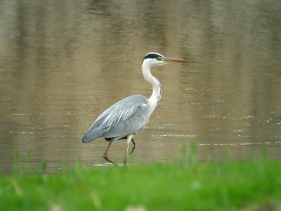
Héron Cendré - Fabrice Croset FaunaThe grey heron
Easy to recognise, the grey heron can be seen hunting along the edge of lakes and in the marshes in the search for amphibians and fish, or even in the middle of agricultural prairies on the lookout for voles. Like all herons, it flies with its neck bent and its legs outstretched, which sets it apart from storks and cranes. It nests in a small colony, called a heronry.
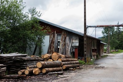
Scierie de l'Abbaye - Nina Verjus - PNRHJ History & HeritageThe mill and sawmill of l’Abbaye en Grandvaux
Since the Middle Ages, monks have used the driving force provided by the lake’s waterfall to work the grinding wheels in the Abbaye’s mill, which was once located where the current sawmill now stands. The water wheel was actioned by a vertical 8-meter-high waterfall. No doubt this first set-up lacked power and a 5-meter dyke was likely constructed to increase the height of the drop and the volume of water in the lake. The lake’s current water level bares no resemblance to its water level during the 6th century; this means it is difficult to locate the original priory. When activity at the mill came to an end (due to a lack of grain to grind!), a sawmill was established on the same site, and turbines replaced the pre-existing wheel. The calm waters in the lake turned into a power source and the facilities that are still in place attest to the different activities that have since developed around the lake.
%20PNRHJ%20-%20F.%20Jeanparis.jpg.400x0_q85.jpg)
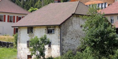
Mitoyenneté - F. Jeanparis History & HeritageAdjoining houses
In hamlets, adjoining farms were often lived in by the same family (several brothers for example). However, each family was still independent and provided for its own needs. The sobriety of the home’s architecture should not detract from the quality of these constructions: the use of cut stone to frame windows, the quality of the framework, the cut and aged lintels, etc.
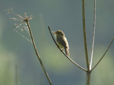
Rousserole verderolle - Fabrice Croset FaunaThe marsh warbler
A migratory bird, this passerine spends winters in Africa, south of the equator. It only returns to the Jura mountains between mid-May and the beginning of August. The marsh warbler lives in more or less marshy prairies with high grass and scattered with bushes, where the male perches itself to sing. Their nest is made of dry grass suspended at mid-height from herbaceous stems. This species is exclusively insectivore (feeds on insects). The European champion of imitation, a male marsh warbler can imitate 80 species with its song, with the known record to be 212!
Évolution de la vie, évolution du bâti. - F. Jeanparis History & HeritageThe evolution of life and buildings
The rural house was first the one belonging to the farmer and livestock breed, where men and animals lived together. As from the 18th century, cheese specialisation and the pooling of milk in cooperative structures - “fruitières” - brought farmers out of a self-subsistence economy. In terms of buildings, the farm became bigger: a storey is added to include bedrooms, a second stable is sometimes built to accommodate more animals.
Description
In front of the Duchet holiday village, exit the car park to find the RD 232 towards the hamlet of Les Piards.
Turn left towards the place called "Les Fans". Descend to the bottom of the valley and reach a junction, Route de la Faicle.
Follow this one, on the left, in the direction of Chaux-des-Prés.
Turn left onto the D 146, cross the village of Chaux-les-Prés and arrive at the junction indicating Château-des-Prés (D 28) on the right.
Follow the road to Château-des-Prés, admire the Douillons bog from the belvedere on your right. Continue on the D 28 until the arrival of Château-des-Prés.
Take, in front of a wayside cross, a motorable path on your left: follow it passing near house no. 10 and come out on the D 437.
Carefully cross the departmental road to take the white path which is in the right bend of the road. At the next crossing, turn left and cross the Pré Basset. At the edge of the wood, continue to the right and arrive near a building.
Turn left and quickly find a forest road. Take it to the right and reach the Belvédère du Moulin.
Take advantage of the viewpoint over the Lac de l'Abbaye and the valley of Grandvaux then continue on the forest road.
At the crossing, turn right and cross the hamlet of Les Cernois.
At its exit, you will have to reach the site of the Abbey of Grandvaux on the left.
After 150 m on the D 437, take a small paved road to the right. Continue on this road to circumvent the lake by the South (a beautiful point of view awaits you in height in the South of the lake) and join the hamlet les Bez by following the first track on the right.
Turn right, carefully cross the hamlet and continue to n° 3. Opposite, a sign indicates the direction of Prénovel de Bise via a forest road.
Continue on this one ignoring the secondary departures on both sides and find the bitumen.
Continue a few meters to the left then fork on the first track on the left. Follow it straight until you reach an inverted Y fork.
Go to the right and, at the exit of the forest, continue straight ahead and reach the "Les Cuinets" sign post.
Take the path on the left and arrive at the Chalet du Bief Plotet.
Go straight on for a few meters then take the track on the left and enter the hamlet of Prénovel de Bise.
At the level of the fountain (unsupervised water), cross the D 28 carefully and follow the small road to the first path on the left. Follow this one which passes close to the peat bog of the Nanchez reach.
At the fork, after the power line, turn right and continue straight until you reach a fork after the sewage treatment plant.
Continue straight, cross the Vuillomets and find the parking lot of the Prénovel village hall.
- Departure : Prénovel, Le Duchet
- Arrival : Prénovel, Le Duchet
- Towns crossed : Nanchez, Grande-Riviere Chateau, and Saint-Pierre
Forecast
Altimetric profile
Sensitive areas
Western capercaillie
- Impacted practices:
- , Land-based
- Sensitivity periods:
- JanFebMarAprMayJunDec
- Contact:
- Impacted practices:
- Aquatic,
- Sensitivity periods:
- JanFebMarAprMayJunJulAugSepOctNovDec
- Contact:
- Parc naturel régional du Haut-Jura
29 Le Village
39310 Lajoux
03 84 34 12 30
www.parc-haut-jura.fr/
Information desks

Tourist information centre - Haut-Jura Grandvaux
7 place Simone Veil, 39150 Saint-Laurent-en-Grandvaux
Report a problem or an error
If you have found an error on this page or if you have noticed any problems during your hike, please report them to us here: