Between Lemme and Saine
The villages that you will pass through - Chaux-des-Crotenay, Entre-Deux-Monts and Les Planches-en-Montagne, overlook the valleys of the Saine and the Lemme. This plateau was possibly the scene of one of the most famous battles in history. Good Gauls!
7 points of interest
%20PNRHJ%20-%20F.%20Jeanparis.jpg.400x0_q85.jpg)
Les falaises du Morillon - F. Jeanparis GeologyThe Morillon cliffs
Cleared by the Lemme, which has formed a wind gap here, the Morillon cliffs are a succession of vertical strata comprised of hard limestone ledges and marlstone layers that are more sensitive to erosion. This is a great location for a lesson in Jura geology: these sedimentary rocks were created around 200 million years ago, and their folds were created due to the mountain pressure between 11 million to 3 million years ago.
Exposed by a geological cut, these layers are very visible and this site - which is now open to experienced climbers - is equipped with an interpretive signpost providing information of how this landscape came to exist.%20PNRHJ%20-%20F.%20Jeanparis.jpg.400x0_q85.jpg)
Étang des Drillettes - F. Jeanparis Lakes & RiversÉtang des Drillettes (Les Drillettes lake)
If you are in the mood for a short break, this calm lake offers an area to relax along the Quenot stream.
From its shaded banks, observe the fish, birds and dragonflies with care in this green oasis full of life - swimming is prohibited!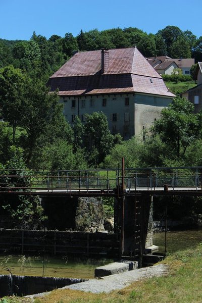
Ancien relais de diligence - Julien Vandelle History & HeritageFormer diligence relays
This imposing structure built in 1789, with a gambrel roof, also called a “Mansard” roof, is comprised of two stories of barns and two stories of cellars. Relays had to be able to accommodate a large number of hitches. For the Grandvallier “rollers” (road hauliers), who worked independently or on behalf of “rolling firms”, these relays were vital stop-offs. At the height of the rolling period, during the mid-19th century, rolling firms such as the famous Maison Bouvet established their own relays in major cities.
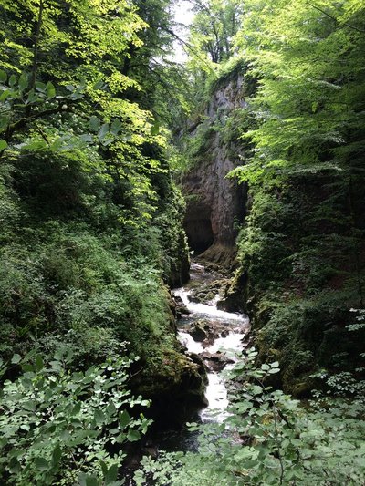
Langouette - GTJ Lakes & RiversTrail of the gorges of the Langouette
Departing from the church, the Langouette faerie accompanies you on this trail marked by interpretive signs which will help you to reveal the secrets of the mysterious waterfalls and gorges of the Langouette, and to admire the wild beauty of this canyon carved by the Saine up-close.
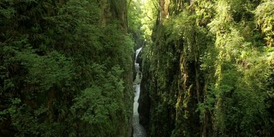
Les gorges de la Langouette - F. Jeanparis WaterfallsThe gorges of the Langouette
A source of legends and history, the gorges of the Langouette are full of beauty and stories waiting to be discovered.
%20PNRHJ%20-%20F.%20Jeanparis.jpg.400x0_q85.jpg)
Belvédère des Prés Grillet - F. Jeanparis ViewpointBelvedere of Les Prés Grillet
At first glance, the landscape from this adapted belvedere offers mainly greenery.
But take a look at its many hues: to the right, the dark gorges carved out by the Saine unfurl and open onto a small and quieter valley, where the river idly winds through a humid area before reaching a small village to your left. This is Syam, known for its smithies and Villa Palladienne.%20PNRHJ%20-%20F.%20Jeanparis.jpg.400x0_q85.jpg)
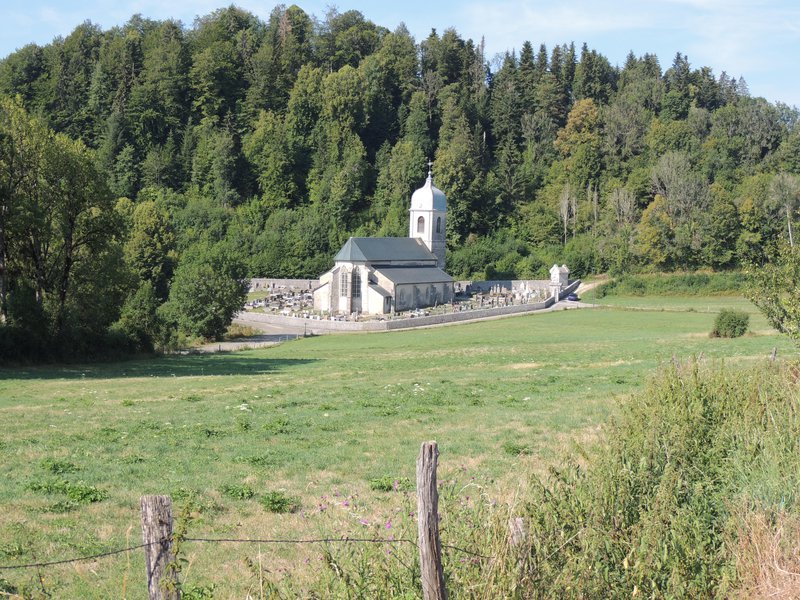
Mairie de Chaux-des-Crotenay - F. Jeanparis History & HeritageChaux-des-Crotenay Town hall
This town hall is dated 1846 and has a remarkable bell tower. The bell - which represents the municipality’s voice, also has importance in civil life. The republican bell tower is managed by the town mayor or the founder and chimes the call of those with rights over the wood in municipal forests, municipal councils and fire hazards, etc.
However, republican bell towers were never truly able to rival with the church bells, and were usually built when the church was too far from the centre of the village. (PNRHJ - Collection patrimoine, “Heritage collection”)
Description
From CHAUX-DES-CROTENAY, head down the tarmac road (red MTB waymarking no. 69) towards Le Gros Tilleul. Turn right to reach La Fontaine Neuve and La Chaux Church.
Branch off to the left on the tarmac road towards La Loye. Take the stony path that enters the forest to your right, towards La Côte Coulon and the Morillon cliffs in LE CERNOIS.
Continue on the stony path that soon turns to tarmac and that runs along the cliffs and heads up to Le Rachet. Take the tarmac road to your right through the open combe of Entre-deux-Monts to reach the hamlet of Les Merets.
Turn onto the road to your right and quickly turn left to take the stony path down towards the forest and up to the Étang des Drillettes (Drillettes lake).
Continue on the muddy path that heads right up to Les Drillettes, and then take the long forest road along the Quenot rivulet to the road in Sous Grateloup.
Carefully cross the départemental road and take the road opposite you that will lead you to the LAVOIR (washhouse) - LES PLANCHES-EN-MONTAGNE via La Fontenette and Le Girod.
Continue on the main village road towards Bas du Village. Head down the road to your left and cross a bridge over the La Langouette gorges. Continue on the road, past LE MARTINET and reach Montliboz.
Branch off to the right on a stony path that then heads up into the forest, towards Derrière la Montagne Ronde (“behind the round mountain”).
Take the muddy path that follows along the right of the D 16 until you reach Chez Tatet, and then take the tarmac road down to La Feuillée au Loup.
Turn left onto a small forest path towards La Voie Sacrée.
Follow the white path to your right for 200 metres, and then turn left into an area with railings and a building. Follow a long and narrow trail through the forest. Exit onto a tarmac road, turn left and follow the trail to LES PRÉS GRILLETS.
After the short out-and-back to the belvedere of Les Prés Grillets, continue on the tarmac road towards La Grande Cheminée.
Descend to your left on the stony forest path and take the winding trail to your right to reach Les Messageries.
Turn left on the tarmac road and reach the hamlet of Cornu. Continue left onto the road to the hamlet and then turn right just before the last farm. Head up the stony path through the pastures to reach Les Champs Montants.
Turn right and return to your point of departure in CHAUX-DES-CROTENAY via a little stony path.
- Departure : Chaux-des-Crotenay
- Arrival : Chaux-des-Crotenay
- Towns crossed : Chaux-Des-Crotenay, Entre-Deux-Monts, and Les Planches-En-Montagne
Forecast
Altimetric profile
Recommandations
Be careful when crossing the D 127 in Sous Grateloux.
For an MTB outing, wear a helmet and bring enough water.
Paths are shared with pedestrians and horse riders, who have priority, therefore, please adapt and control your speed.
To use MTB paths, do not hesitate to get down from your bike.
This trail passes through pastures and forest paths. To respect the owners and farmers granting you passage, and for the security of livestock and wild fauna, we ask that you remain on the waymarked paths and close gates behind you where there are no MTB paths.
Wild flowers are beautiful, they may be rare and protected and often wilt quickly. Do not pick them! They will delight the next admirers.
In case of forest works (felling, skidding, etc.), for your safety, know when to stop and turn around.
Transport
To visit and get about in the High-Jura, visit www.reshaut-jura.fr, the eco-mobility portal listing all means of transport within the Park.
Access and parking
11 km south of Champagnole via the N 5 to Pont de la Chaux followed by the D 16.
Parking :
Report a problem or an error
If you have found an error on this page or if you have noticed any problems during your hike, please report them to us here: