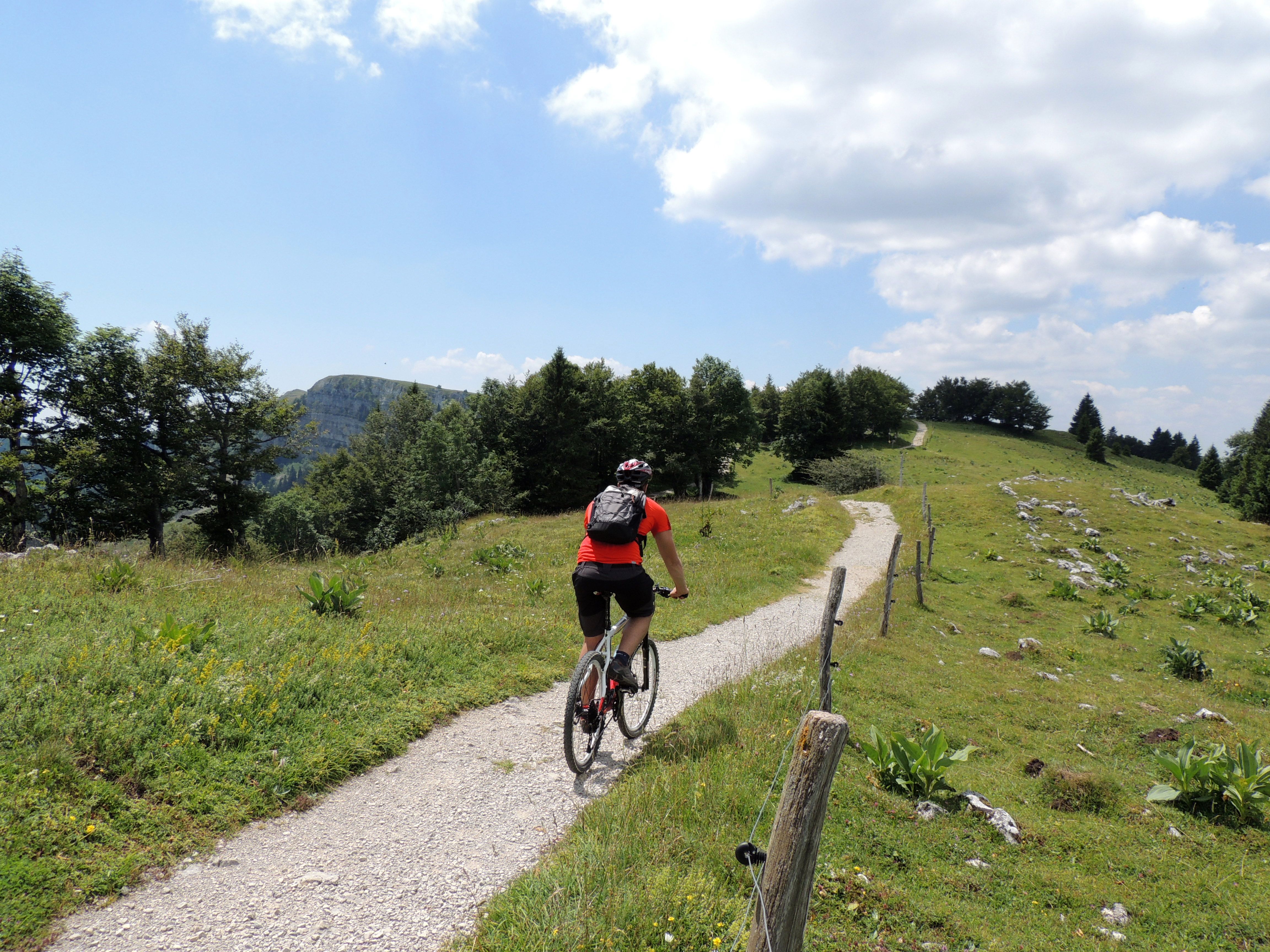
Alpine pastures along the ridges
In addition to significant differences in terrain level - which can be erased with electrical assistance - this circuit offers short technical sections, both when ascending and when descending, and particularly along the ridges. An athletic circuit where we recommend taking your time to appreciate the diversity of the landscape.
7 points of interest
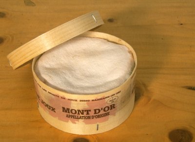
Mont d'Or ou vacherin - PNRHJ Know-howThe Mont d’Or
Also called the “vacherin” of the High Doubs, the Mont d’Or is a soft, lightly pressed cheese. To receive the controlled designation of origin, it is made from 15 August to 15 March, at over 700 m of altitude in a geographical area delimited by the Doubs’ source, the Swiss border and the Saut du Doubs. Made from the raw milk of Montbéliarde cows, once removed from the mould, its curd is surrounded by a spruce “strap”, made from the soft area of the tree between the bark and the sapwood. During maturation, it is rubbed with salted water and turned on a daily basis for at least 3 weeks, before being inserted in a spruce box.
Crête du Mont d'Or - GTJ / F. Berlluchi FloraThe treasures of the Mont d’Or ridge
A true “botanical garden”, the high-altitude lawns of the Mont d’Or ridge are home to exceptional floral diversity. Rare flowers, such as the Pulsatilla alpina or the Nigritella have found refuge here. As part of a rational development policy, this exceptional site has been classed a Sensitive Natural Area by the Département of Doubs and has also been included in the European network of protected Natura 2000 sites. These classifications aim to reconcile human activities with environmental sensitivities, thereby allowing to protect and highlight the area whilst ensuring the territory’s economic viability.
To find out more, visit: www.doubs.fr/index.php/les-espaces-naturels-sensibles.
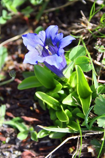
Gentiane acaule - PNRHJ / Marion Brunel FloraThe Stemless Gentian
In the pastures below the Mont d’Or, deep blue trumpet flowers draw the eye. The Stemless Gentian (or Kock’s Gentian) is a species whose rarity equals its beauty. It owes its name (acaulis = “stemless”) to its very short stem. It blooms quite early in the season; the months of May or June should be preferred to be lucky enough to see one. Be careful, this is a protected species in the Franche-Comté region, hikers must therefore content themselves with observing them, and must not pick them! Here, it can be found with its very similar cousin, the Clusus Gentian. To tell the difference, you will need a lot of patience.
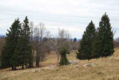
Épicéas toupies - PNRHJ / Marion Brunel Pastoralism and agricultureWoodlands and “spinning top” spruces
In the Jura Arc, men have designed areas in which cattle farming and the exploitation of wood coexist, shaping distinctive landscapes and particular biodiversity: woodlands. A symbol of this coexistence, “spinning top” spruces owe their unique form to the teeth of livestock. To survive their grazing, the tree reacts with a thick branching, mirroring a tree shaped like a bonsai.
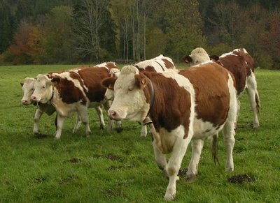
Génisses - PNRHJ / Gilles Prost Pastoralism and agricultureThe alpine pasture
Between the end of May and the end of September, it’s the summer season. However, on this cheese-making mountain, there are almost no milking cows still in the alpine pasture. These pastures have become home mainly to heifers, young females that have not yet calved. The production of Comté and of Morbier happens “at the bottom”, in the valley. And although the Mont d’Or mountain bears the name of another famous cheese, it is only during the long Jura winter, in the stables, that cows produce the milk for this specific cheese.
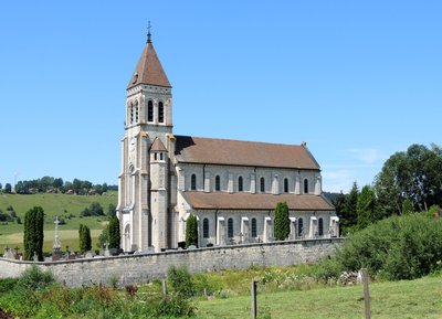
Église de Longeville - PNRHJ - F. Jeanparis History & HeritageLongeville-Mont d’Or church
The Saint-Sylvestre parish church was built between 1860 and 1863 to replace the old church which was built in 1445 and had become too small to accommodate all of Longeville’s inhabitants. Its construction was completed thanks to Napoleon III’s gift of 5000 francs and Jacques Séraphin Lanquetin’s contribution of 4000 francs, with the latter having been born in Longeville and working as a wine trader in Paris where he is elected a member of parliament in 1852.
The 25-meter high bell tower of this imposing structure houses two monumental bells, one named “Marie” weighing 1,500 kg and the other named “Anne” weighing 1,100 kg. Both were made in Morteau by Etablissement Bournez in 1857.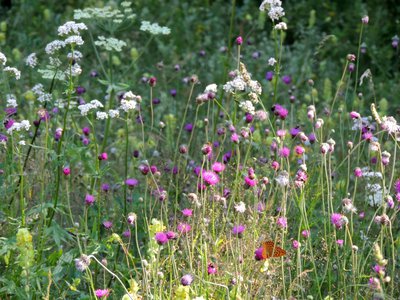
Prairie fleurie - PNRHJ - F. Jeanparis Pastoralism and agricultureFlowered meadows
Cattle only grazes in the hayfields from autumn. Vegetation is left to grow during the good season and then the meadow is mowed once or twice depending on the weather to build up hay reserves for the livestock in the winter.
These meadows are home to a wide range of plants and particularly flowers which give colour to the High-Jura agricultural landscape. There is a national environmental “competition” called “the flowered meadows” which encourages farmers to promote this diversity, particularly by adjusting the dates on which they mow their fields.
Description
From the Métabief Tourist Office (

 ) take the tarmac road that heads up towards MOROND.
Follow this road (red MTB waymarking no. 77) heading through the crossroads at La Cheneau, La Fontaine aux Oiseaux, Tournant des Canons, Monrond and Sous le Monrond until you reach Sous la Citerne.
From here, you can reach the summit of the MOROND to make the most of your first beautiful viewpoint.
Take the “chemin des crêtes” until you come to the Mont d’Or parking lot.
The Mont d’Or summit can be accessed by foot from here within 10 minutes.
From the parking lot, follow the road to the Pâturages de la Grangette (La Grangette pastures).
Branch off to your right on a narrow grassy trail that heads down through the pastures and wooded meadows. At La Barthelette, continue on the trail to your left which opens onto a little road. Take the road to your left, then turn right and continue on until you reach the alpine pasture farm of la Bartelette.
Turn left and follow a grassy trail through the pastures, gradually ascending into the forest, and exit onto LA BOISSAUDE ( ).
).
Head past the old farm and descend to your right on an open trail to join up with a tarmac road, you will soon come to LES GRANGES RAGUIN.
Turn right after the building and take the muddy and stony path that runs along a meadow and then descends into the forest. Take the tarmac road and follow it for 700 m. Turn right onto a small trail to reach Les Toises. Continue to your right and reach the road in Les Meix.
Turn right again and head through a small wooded area to reach Les Chapusets. Head approximately 700 m down the road to your left, before turning right and coming to Les Crétets and La Roche.
Follow the road to your right until you reach the heart of LES LONGEVILLES (

 ).
).
Just before the church, turn right, head past the town hall and take the white path to your left until you reach Les Perrières and head on to the METABIEF TOURIST OFFICE.
- Departure : Tourist Office, Métabief
- Arrival : Tourist Office, Métabief
- Towns crossed : Metabief, Jougne, Longevilles-Mont-D'Or, and Rochejean
Forecast
Altimetric profile
Recommandations
For your safety and to limit the erosion of the lawns on the summits between the Morond and the Mont d’Or, we ask that you remain on paths waymarked for MTB.
For an MTB outing, wear a helmet and bring enough water.
Paths are shared with pedestrians and horse riders, who have priority, and there can be many of them on the Mont d’Or ridges. Therefore, please adapt and control your speed.
To use MTB paths, do not hesitate to get down from your bike.
This trail passes through pastures and forest paths. To respect the owners and farmers granting you passage, and for the security of livestock and wild fauna, we ask that you remain on the waymarked paths and close gates behind you where there are no MTB paths.
Wild flowers are beautiful, they may be rare and protected and often wilt quickly. Do not pick them! They will delight the next admirers.
In case of forest works (felling, skidding, etc.), for your safety, know when to stop and turn around.
Information desks
Tourist information centre - Métabief
6 place Xavier Authier, F-25370 Métabief
Transport
Access and parking
Parking :
Report a problem or an error
If you have found an error on this page or if you have noticed any problems during your hike, please report them to us here:

