The Tram Line
An easy circuit crossing through prairies, forests and the village of Confort in the Valserine’s valley, with the spectacular Stone Mill Bridge as a highlight, erected on either side of the gorges and cut into the limestone. On approaching Bellegarde, you can even test your balance on two wheels on a succession of several exercises of varying levels of difficulty.
5 points of interest
La Voie du Tram à La Mulaz - PNRHJ - F. Jeanparis History & HeritageThe Tram from Bellegarde to Chézery
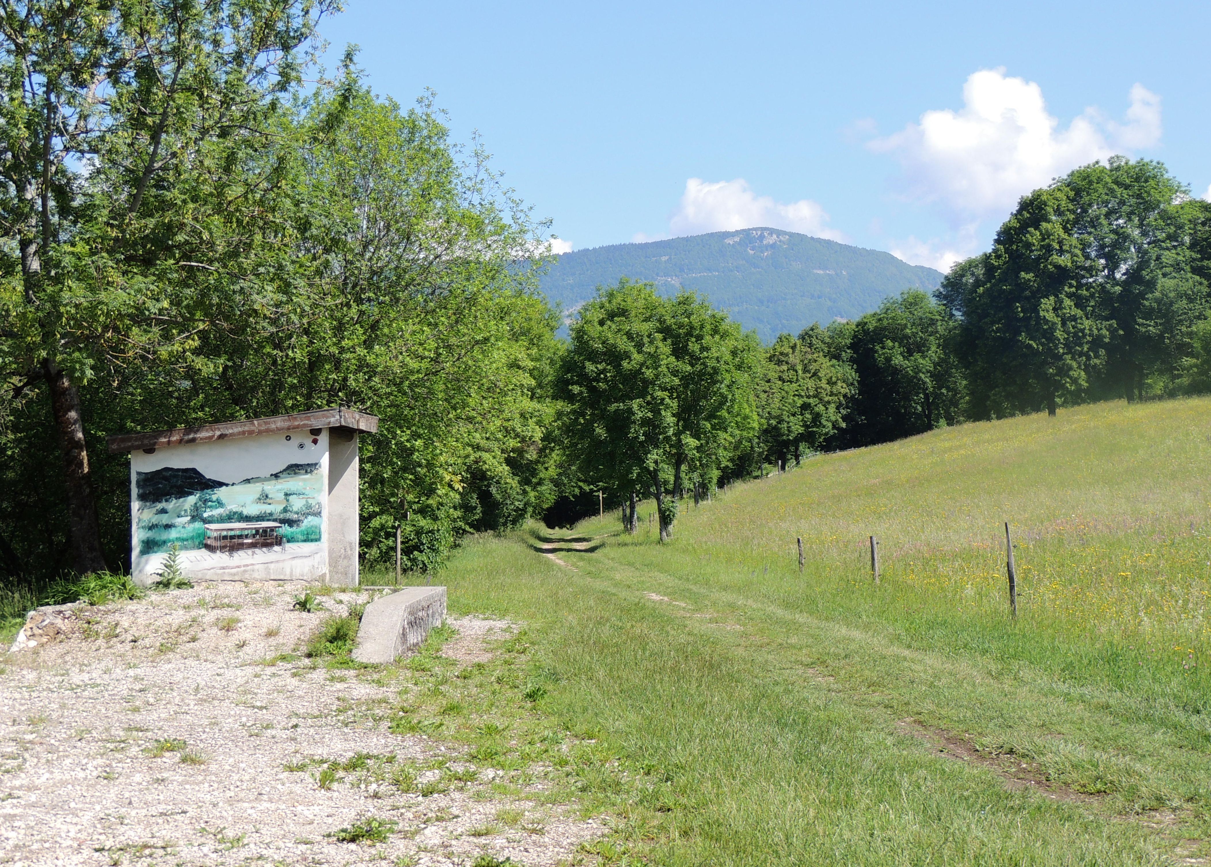
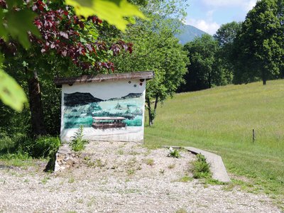
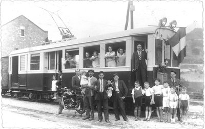
The Tramway was a local-interest railway line which linked Bellegarde-sur-Valserine to Chézery-Forens via Lacrans, Confort, Montanges and Champfromier: a 20 km journey lasting 1H40. The works started in 1907 and included the construction of 6 stations, 3 bridges (one of which was the Moulin des Pierres bridge), 1 tunnel, 2 customs houses and 1 power plant (Sous Roche in Champfromier) to power the train. Opened in 1912, the tramline slowly accumulated financial losses due to the rise of motor vehicles and stopped running in 1937 despite the inhabitants’ opinion.
Inauguration du Tram - Michel Blanc History & HeritageLa Mulaz train station
The Mulaz train station was one of six stations on the Bellegarde-Chézery line and served the hamlets of la Mulaz and la Serpentouze. The Tram Line linked the villages in the Valserine valley with Bellegarde and provided opportunities to both inhabitants and companies. The line’s three engines also pulled freight wagons and opened-up the sawmills of Chézery and Champfromier, the plaster factory in Pré-Basson and the asphalt mines in Forens.
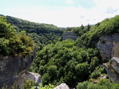
Les gorges de la Valserine - PNRHJ - F. Jeanparis Natural environmentsThe Pont des Pierres Natural Regional Reserve
In 1927, an abandoned hydroelectric power plant project led to the excavation of a gallery in the gorges of the Valserine. As early as 1969, 17 species of bats, including 7 endangered species were listed as living in these galleries. For their protection, these galleries are now closed to the public. The natural reserve that was created as a result also protects the cliffs and other natural surface habitats recognised as remarkable areas by Europe.
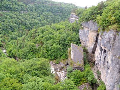
Les gorges de la Valserine - PNRHJ - F. Jeanparis GeologyRocky environments
The landscape surrounding you is the result of 200 million years of erosion, shaped by the ice age, runoff waters, changes in temperature, wind, etc. The Pont des Pierres offers a viewpoint from which you can see the different ways in which the gorges have been eroded: glacial and fluvial deposits, fracture of the cliffside, glacial polish, tufa, etc.
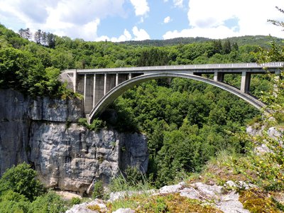
Le Pont du Moulin des Pierres - PNRHJ - F. Jeanparis History & HeritageThe Moulin des Pierres bridge
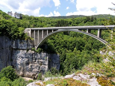
Construction of the Moulin des Pierres bridge started in 1908. Huge wooden scaffolding was put up to build the 80-metre cut-stone archway, and over 100 workers were employed. Opened in 1909, at the time it was one of the biggest bridges in Europe. Large numbers of goods and people crossed the bridge every day. The duty-free zone that once followed the line of the Valserine river meant that a customs building needed to be built to monitor passage over the bridge up until 1923 when the borders were pushed back to the Jura ridges. During the Second World War, the bridge was blown up by the secret army who used dynamite to stop the Germany army from retreating. It was later rebuilt identically using concrete in 1954.
Description
From the Tram Line - Departure parking lot, take the stony path on a steady ascent towards Confort.
In Confort, descend to the square where a carriage has been turned into a restaurant, then turn left onto route de Pelant, towards Chézery via the Tram Line.
After following along the side of the D991, the stony path heads away from it and continues across fields, before reaching the La Mulaz Train Station.
Continue on the same grassy path that now heads through a forest, continuing towards Chézery via the Tram Line. You will quickly arrive at the Stone Mill Bridge (viewpoint over the rocky chaos of the gorges from the bridge).
Within 30 mins there and back on foot, you can also access the adapted belvedere on the right embankment, which is well visible from the bridge, and which offers another view of the edifice and of the gorges: follow the waymarking path to the right of the road for 300 m, then cross the road to descend to the right to the viewpoint.
Return the same way.
- Departure : Parking lot for the Tram Line departure point
- Arrival : Parking lot for the Tram Line departure point
- Towns crossed : Valserhone and Confort
Forecast
Altimetric profile
Recommandations
The agility workshops scattered across the trail cover several experience levels, starting with a beginner's level (green) to test your balance. Be careful.
This circuit being an out-and-back, you can also start at the Stone Mille Bridge, between Confort and Montanges.
For an MTB outing, wear a helmet and bring enough water.
Paths are shared with pedestrians and horse riders, who have priority, therefore, please adapt and control your speed.
This trail passes through pastures and forest paths. To respect the owners granting you passage, and for the security of livestock and wild fauna, we ask that you remain on the waymarked paths.
Wild flowers are beautiful, they may be rare and protected and often wilt quickly. Do not pick them! They will delight the next hikers.
In case of forest works (felling, skidding, etc.), for your safety, know when to stop and turn around.
Information desks
Tourist information centre - Terre Valserine
71 rue de la République, 01200 Valserhône
Transport
To visit and get about in the High-Jura, visit www.reshaut-jura.fr, the eco-mobility portal listing all means of transport within the Park.
Access and parking
1.5 km north of Bellegard-sur-Valserine, (accessible via the A40) via the D 1084, and then via the D991 towards Lancrans. The parking lot is located between La Pierre and Lancrans.
Parking :
Report a problem or an error
If you have found an error on this page or if you have noticed any problems during your hike, please report them to us here:
Close by1
- Laid-out site
Laid-out site
The Moulin des Pierres bridge
A historic and symbolic structure representing industrial development and trade in the Jura, the Moulin des Pierres bridge is also a remarkable natural site that can be admired from the 40-meter high bridge or from the belvedere close by. Here, the Valserine has carved deep gorges in which tenacious plants have overtaken the rocky sides underlining the valley. The bridge’s daring construction offers a unique view over the Pont des Pierres Natural Regional Reserve.

