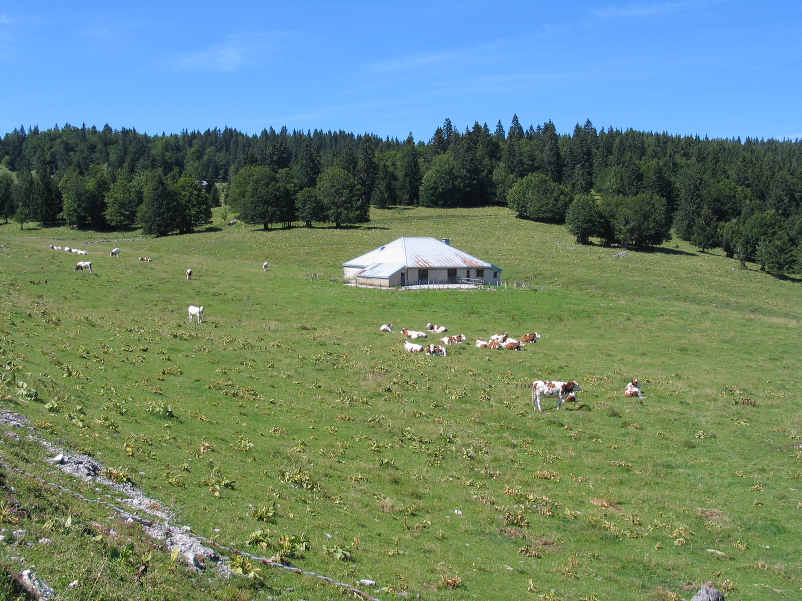
Around Pièce d’Aval
Approaching the Massacre forest and at the foot of the Crêt de la Vigoureuse, this trail is a true learning experience on crossing MTB paths, around twelve of them, without it becoming an obstacle course.
13 points of interest
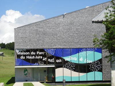
Maison du Parc - PNRHJ / Patricia Louvrier History & HeritageThe Maison du Parc
The Maison du Parc, which serves as head office for the High-Jura Regional Natural Park, has remarkable architecture and shingled facades. It offers visitors a chance to discover the region through exhibits, projections and a tour of a “Grenier-fort” (a strong attic). The exhibit takes visitors through each of the aspects of the High-Jura, in a colourful, modern and interactive setting: landscapes, nature, craftsmanship and industries, tourism, agriculture and forestry. An acoustic stroll offers an unexpected, poetic and vivid opportunity to submerge oneself into nature in the High-Jura through its exceptional sounds. Finally, two remarkable and recent films on landscapes complete and illustrate the visit: one on the geology of the Jura massif and the other on peat bogs.
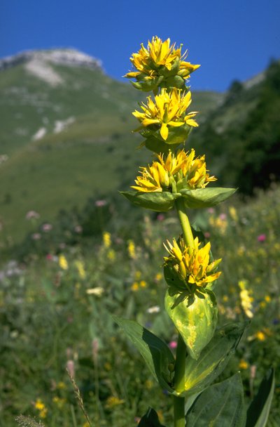
Gentiane jaune - PNRHJ / Jean Claude Marchand FloraIn the middle of the flowers, the great yellow gentian
Typical of these environments, the great yellow gentian will be by your side every step of this hike. A fun fact: if you squash the gentian’s fruit between your fingers, do you recognise the smell? It smells of peas.
Route Royale - PNRHJ / Gilles Prost History & HeritageRoute Royale (Royal Road), Route du Sel (Salt Road)
The road you are on is called “Route Royale” (Royal Road) or “Route du Sel” (Salt Road), which once linked Saint-Claude to Geneva via Mijoux and Gex. At the time, the Jura would sell salt from Lons-le-Saunier to Switzerland. The road was built in 1742 by “corvées”: taxes paid in days of work.
The narrow “Route Royale” was deemed too dangerous due to its short steep bends and was replaced during the early 20th century by the current road between Lajoux and the La Faucille pass.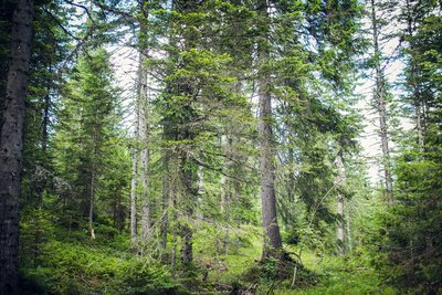
Futaie jardinée - PNRHJ / Léo Poudré Know-howSelection forests
How beautiful and natural are the High-Jura forests? Did we say natural? Well not entirely: they bear the mark of Man, who has exploited these lands for centuries. Here, forests are “managed”: mature trees are harvested first, a diverse range of species and ages are preserved and the forest regenerates by itself. Local knowledge is used to serve a diverse range of wood activities (carpentry, construction, cheese boxes, shingles, toys, firewood, etc.).
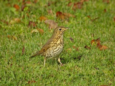
Grive musicienne - Fabrice Croset FaunaThe song thrush
There’s no approaching a forest on a spring morning without hearing the song thrush. Its loud chant is essentially based on short musical patterns that it repeats two or three times. It builds its nests in forked branches.
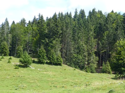
Forêt d'altitude - PNRHJ / Gilles Prost Natural environmentsHigh forests
Here, you are at an altitude of 1200 metres. Altitude decides which trees are found in the forest, based on each species’ preference. The two main coniferous trees in this forest are the spruce and the pine tree. A few small details set these trees apart. Can you tell which is which? The spruce has brown bark and round needles, whilst the pine tree has a greyer trunk with flat and vivid green needles.
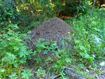
Fourmilière - PNRHJ / Gilles Prost FaunaThousands of interrelated species
Red ant nests are easy to spot in this clearing. It is said that up to 2000 insect species can live in these nests. Some use the ant nest without causing any damage, whilst others are parasites. This mound of twigs also serves as a pantry to the black woodpecker who feeds on ants. This same bird bores holes into tree trunks in the search of larvae. When these holes are abandoned by the woodpecker, the boreal owl uses them as a temporary home.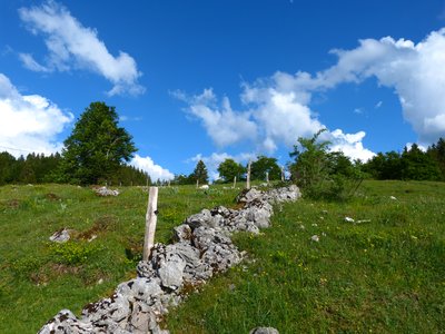
Muret - PNRHJ / Gilles Prost History & HeritageLow dry-stone walls
Low dry-stone walls have outlined Jura landscapes for centuries. They set out the limits for plots of land, mark the frontier between France and Switzerland, border hay fields or vegetable plots and flank the “vies” (lanes). Built without any binding agent, these dry-stone walls are constructed according to ancestral building practices. Now typical features of these landscapes, they are also home to a remarkably diverse fauna and flora.
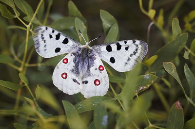
Apollon - PNRHJ / Léo Poudré FaunaThe Apollo, an iconic guest in these lawns
No Greek gods in this area, but rather a rare and protected butterfly that flits from flower to flower on High-Jura lawns. The caterpillar develops on stonecrops (small succulent plants) and transforms into a fabulous white-winged butterfly with red spots. Although the Apollo is shy, you may be able to see one atop knapweeds or umbellifers. Keep your eyes peeled!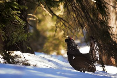
Grand Tétras - PNRHJ / Léo Poudré FaunaAn order protecting the western capercaillie
Here, you are at Pièce d’Aval. To the north is most of the Massacre Forest, which is home to the western capercaillie.
Today, due to the species’ strong decline in numbers, it is protected by an APPB biotope protection order, which regulates all types of travel in the Massacre forest (on foot, on skis, by car). Thus, the western capercaillie is protected during two particularly sensitive periods of its life: winter and mating season.
Chalet de la pièce d'Aval au pied de la forêt du Massacre - PNRHJ / Philippe Andlauer History & HeritageMassacre forest and Geneva
Massacre forest (“forêt du Massacre”) is named after one of the war episodes having occurred between the 13th and the 18th century and which opposed the Bernese, the Vaudois, the Savoyards and the French in their desire to govern Geneva. During the 16th century, Geneva became an important European trade centre, at the expense of Lyon, Chalon-Sur-Saône and Dijon. At the time, Bern was attempting to introduce Protestantism to Geneva, and the Savoie wanted to claim this strategic city for itself. In 1535, Francis I, who was then an ally to the Bernese, decided to send a division of one thousand Italian mercenaries to defend the city. When heading back up the Valserine valley to cross over the Faucille pass, his troops were blocked of by the Duke of Savoie’s army. They were pushed back into the Mountain forests just above Lajoux, and his soldiers were wiped out by the Savoyards’ axes.
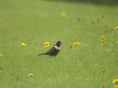
Merle à plastron - Fabrice Croset FaunaThe ring ouzel
This large member of the thrush family with a white neck lives in high-altitude areas and appears to be suffering from climate change. Its numbers are dwindling. However, a study of its migration patterns is also showing that this bird is having more and more difficulty in finding food during the winter in North Africa, as the junipers that it feeds on there are being cut to heat villages.

Fourmilière - PNRHJ / Gilles Prost FaunaThe red wood ant
On a walk through the forest, you will surely come across mounds of twigs created by red wood ants. Ant nests are built like actual cities and are home to several hundreds of thousands of individuals all organised to ensure their survival and their development. Although they feed in part on the honeydew left by aphids on spruces, they also regulate “pest” insects in the forest by eating them. This is why they are protected and must be respected. They don’t have many natural predators, only black woodpeckers and badgers.
Description
From LAJOUX, the trail cuts through the village towards MIJOUX (32 Blue MTB waymark), heading past the front of the Maison du Parc. At Route Royale, the road ascends steeply and reaches a pasture (2 MTB paths). The path continues pleasantly until it reaches Trécombe.
Branch off to your left on a forest path that is rocky, muddy and hilly (MTB path). Exit through the pasture and descend the combe to the left (grassy path) for 300 m before coming to the intersection at La Pièce du Châtelain to your right.
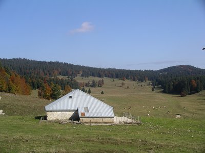
The grassy trail heads over the low wall (MTB path) before ascending through a pasture along the edge of the forest (MTB path). Take a road (MTB path) to Sermangindre (chalet). Cross a second cycling path to follow the trail parallel to the road through several pastures (MTB path) until you come to La Pièce d’Aval (MTB path).
Head up the road to the left for 300 m then take the “chemin de la Combe du Sous” to your left (MTB path).
Head past La Balise d’Amont before coming to Sous la Vigoureuse (MTB path), and later the houses in Chez Gauthon (MTB path). Continue on this path through a small woods (MTB path) that then joins up with the Route Sur le Champs.
Return to your starting point in LAJOUX via the road to your left.
- Departure : Lajoux
- Arrival : Lajoux
- Towns crossed : Lajoux
Forecast
Recommandations
For an MTB outing, wear a helmet and bring enough water.
Paths are shared with pedestrians and horse riders, who have priority, therefore, please adapt and control your speed.
To use MTB paths, do not hesitate to get down from your bike.
This trail passes through pastures and forest paths. To respect the owners and farmers granting you passage, and for the security of livestock and wild fauna, we ask that you remain on the waymarked paths and close gates behind you where there are no MTB paths.
Wild flowers are beautiful, they may be rare and protected and often wilt quickly. Do not pick them! They will delight the next hikers.
In case of forest works (felling, skidding, etc.), for your safety, know when to stop and turn around.
Information desks

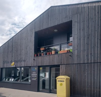
Tourist information centre - Haut-Jura Saint-Claude
3 place de l'Abbaye, 39200 Saint-Claude
Transport
To visit and get about in the High-Jura, visit www.reshaut-jura.fr, the eco-mobility portal listing all means of transport within the Park.
Access and parking
20 km east of Saint-Claude via the D 436 through Septmoncel.
Parking :
Report a problem or an error
If you have found an error on this page or if you have noticed any problems during your hike, please report them to us here: