Massacre Forest trail
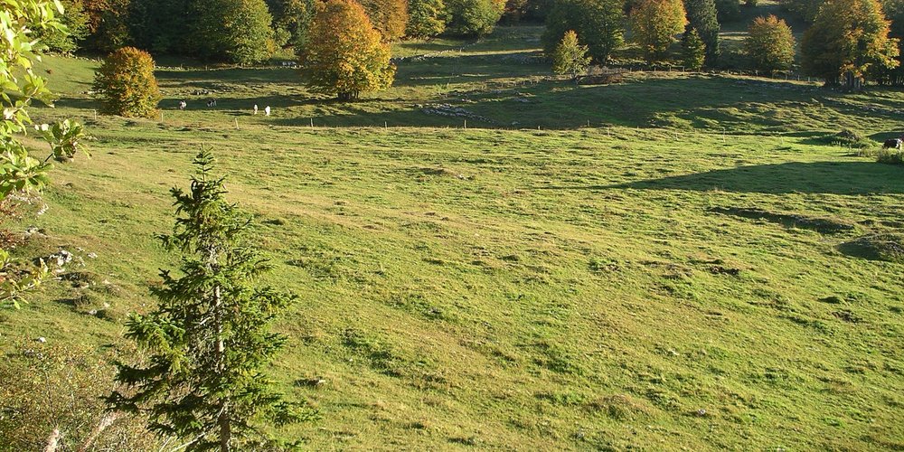
The former clearings, profiting subsistence farming and nowadays organic cheese production, have opened the way for large spaces with an extremely rich flora. In spring, the crocuses open the ball, quickly followed by spring gentian, elder-flowered orchids and Lady’s Mantle.
15 points of interest

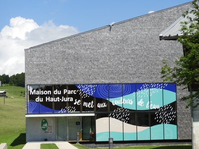
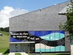
La Maison du Parc - Patricia Louvrier - PNRHJ History & HeritageThe Maison du Parc
The Maison du Parc, which serves as head office for the High-Jura Regional Natural Park, has remarkable architecture and shingled facades. It offers visitors a chance to discover the region through exhibits, projections and a tour of a “Grenier-fort” (a strong attic). The exhibit takes visitors through each of the aspects of the High-Jura, in a colourful, modern and interactive setting: landscapes, nature, craftsmanship and industries, tourism, agriculture and forestry. An acoustic stroll offers an unexpected, poetic and vivid opportunity to submerge oneself into nature in the High-Jura through its exceptional sounds. Finally, two remarkable and recent films on landscapes complete and illustrate the visit: one on the geology of the Jura massif and the other on peat bogs.
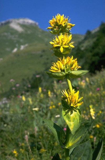
Gentiane Jaune - Jean-Claude Marchand FloraIn the middle of the flowers, the great yellow gentian
Typical of these environments, the great yellow gentian will be by your side every step of this hike. A fun fact: if you squash the gentian’s fruit between your fingers, do you recognise the smell? It smells of peas.
Route Royale, Route du sel - Gilles Prost - PNRHJ History & HeritageRoute Royale (Royal Road), Route du Sel (Salt Road)
The road you are on is called “Route Royale” (Royal Road) or “Route du Sel” (Salt Road), which once linked Saint-Claude to Geneva via Mijoux and Gex. At the time, the Jura would sell salt from Lons-le-Saunier to Switzerland. The road was built in 1742 by “corvées”: taxes paid in days of work.
The narrow “Route Royale” was deemed too dangerous due to its short steep bends and was replaced during the early 20th century by the current road between Lajoux and the La Faucille pass.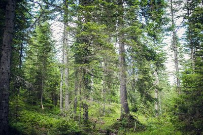
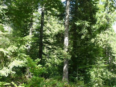
La futaie jardinée - Léo Poudré - PNRHJ Know-howSelection forests
How beautiful and natural are the High-Jura forests? Did we say natural? Well not entirely: they bear the mark of Man, who has exploited these lands for centuries. Here, forests are “managed”: mature trees are harvested first, a diverse range of species and ages are preserved and the forest regenerates by itself. Local knowledge is used to serve a diverse range of wood activities (carpentry, construction, cheese boxes, shingles, toys, firewood, etc.).
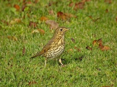
La Grive musicienne - Gilles Prost - PNRHJ FaunaThe song thrush
There’s no approaching a forest on a spring morning without hearing the song thrush. Its loud chant is essentially based on short musical patterns that it repeats two or three times. It builds its nests in forked branches.
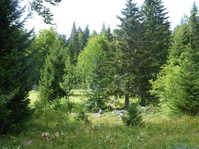
La forêt d'altitude - Gilles Prost - PNRHJ Natural environmentsHigh forests
Here, you are at an altitude of 1200 metres. Altitude decides which trees are found in the forest, based on each species’ preference. The two main coniferous trees in this forest are the spruce and the pine tree. A few small details set these trees apart. Can you tell which is which? The spruce has brown bark and round needles, whilst the pine tree has a greyer trunk with flat and vivid green needles.
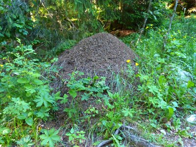
Fourmillière - Gilles Prost - PNRHJ FaunaThousands of interrelated species
Red ant nests are easy to spot in this clearing. It is said that up to 2000 insect species can live in these nests. Some use the ant nest without causing any damage, whilst others are parasites. This mound of twigs also serves as a pantry to the black woodpecker who feeds on ants. This same bird bores holes into tree trunks in the search of larvae. When these holes are abandoned by the woodpecker, the boreal owl uses them as a temporary home.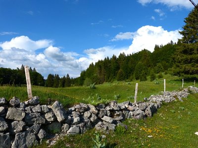
Les murets en pierres sèches - Gilles Prost - PNRHJ History & HeritageLow dry-stone walls
Low dry-stone walls have outlined Jura landscapes for centuries. They set out the limits for plots of land, mark the frontier between France and Switzerland, border hay fields or vegetable plots and flank the “vies” (lanes). Built without any binding agent, these dry-stone walls are constructed according to ancestral building practices. Now typical features of these landscapes, they are also home to a remarkably diverse fauna and flora.
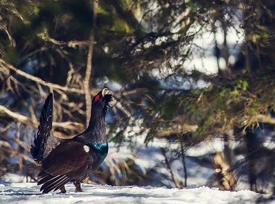
Le grand Tétras - Léo Poudré - PNRHJ FaunaThe western capercaillie
Further north, the Forêt du Massacre (Massacre forest) is home to one of the High-Jura’s most iconic birds: the western capercaillie. A sign of the diversity of high forests, this bird - also known as the wood grouse - is omnipresent here. The male favours old forests, while the female, who moves around more, prefers to spend her winters in bushy areas and raise her young in clearings. This bird is particularly sensitive to disturbances in the winter. There isn’t much chance of seeing one, but if you do, be sure to stay quiet and make the most of this extraordinary moment.
Le crû est à croître en héritage - Gilles Prost - PNRHJ History & HeritageWhat is grown must grow through heritage
During the 19th century, pastures held more value than woods. Dividing land at each change in generation would have led to these lands being progressively split up until they lost all value. For this reason, families in the High-Jura found an original legal arrangement to share inheritance without dividing plots of land: “what is grown must grow”. With what is grown being the trees, and what must grow being the grass that is harvested as hay or that is grazed on every year.
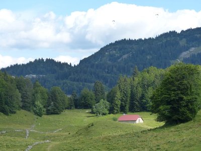
Des loges de la chatelaine - Gilles Prost - PNRHJ History & HeritageCabins in the middle of pastures
When the forests started being cleared during the 12th century, driven by the monks of the Saint-Claude abbey, residents of the High-Jura opened-up the High Combes. They created vast areas for grazing, in which they built cabins useful for milking in the summer. The cabin to your right, at the bottom of the combe below the road, is called the “Cannonière”. Its architecture is typical of cabins in this region. It is one of the rare examples that is still used for agricultural purposes. Here, pastures are used by Montbeliarde cows, who produce milk for cheese.
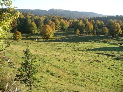
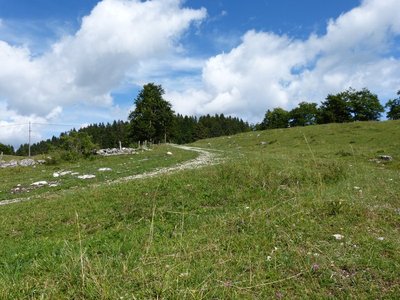
Pré-bois et rochers - P. Andlauer Natural environmentsWooded meadows and rocks
You are now between a pasture and a forest, which is typically known here as a wooded meadow. Typical of the High-Jura landscape, the preservation of these environments is closely tied to grazing habits and they tend to close up as soon as grazing decreases.
Take a few minutes to also notice how rocks have been colonised by pioneer plants. Through the gradual appearance of lichen and moss in the forest, this wooded meadow provides a summary of how landscapes have evolved.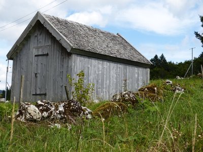
Grenier fort - History & HeritageWell-protected wealth
To the left of your path, you will see a “grenier fort”, or a strong attic, set back from the main house. What is in there today, no one knows. But do feel free to visit the strong attic of the Maison du Parc in Lajoux. The keys alone are worth the detour!
La mainmorte - Gilles Prost - PNRHJ History & HeritageMortmain, the serfdom of abbeys
The Haute-Joux conquest started here in the 5th century. During the 15th century, a type of serfdom imposed by the very powerful Saint-Claude abbey forced families to stay under the same roof: this was called mortmain.
In a certain way, mortmain was the start of craftsmanship at home, as to leave for work in the city was to risk losing family property. Flora
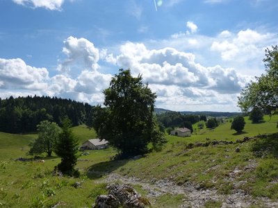
FloraFloral diversity in natural prairies
The prairies stretching out before you are one of the High-Jura’s treasures. Here, hayfields contain a wide range of plants. Never laboured or sown, most prairies in the region are natural.
Description
From LAJOUX, the trail cuts through the village towards Mijoux (white and red waymarking), heading past the front of the Maison du Parc. At Route Royale, the road ascends steeply and reaches a pasture (MTB path). The path continues pleasantly until it reaches Trécombe.
Branch off to your left (yellow waymarking) on a forest path that is rocky, muddy and hilly. Exit through the pasture and descend the combe to the left on a grassy path. Continue on this path, leaving the intersection at La Pièce du Châtelain to your right and heading to Le Petit Pré (white and red waymarking).
The grassy and later stony path (yellow waymarking) descends to your left, and heads past the farms in Sur la Joux before coming to “route du Massacre”. Follow the road to your left for 50 m before joining up with Route Royale and LAJOUX via the path just under the road.
- Departure : Maison du Parc in Lajoux
- Arrival : Maison du Parc in Lajoux
- Towns crossed : Lajoux
Forecast
Recommandations
This trail passes through pastures with livestock and forest paths. To respect the owners and farmers granting you passage, and for the security of livestock and wild fauna, we ask that you remain on the waymarked paths.
Use the adapted passageways to get across fencing and be sure to close gateways behind you. Lastly, please keep your dog on a lead if you have one.
Wild flowers are beautiful, they may be rare and protected and often wilt quickly. Do not pick them! They will delight the next hikers.
In case of forest works (felling, skidding, etc.), for your safety, know when to stop and turn around.
Information desks
Maison du Parc
29, Le Village, 39310 Lajoux

Tourist information centre - Haut-Jura Saint-Claude
3 place de l'Abbaye, 39200 Saint-Claude
Transport
To visit and get about in the High-Jura, visit www.reshaut-jura.fr, the eco-mobility portal listing all means of transport within the Park.
Access and parking
20 km east of Saint-Claude via the D 436.
Parking :
Report a problem or an error
If you have found an error on this page or if you have noticed any problems during your hike, please report them to us here: