Perroud bridge
Under the cover of the forest, the forebay of la Chaille flows through an intimate location, using the whisper of its rapids like music in a game of seduction.
5 points of interest
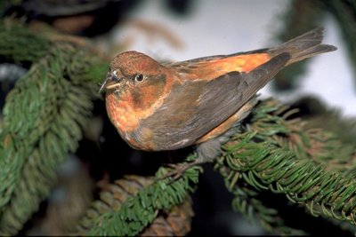
Bec croisé des sapins - Claude Nardin FaunaThe red crossbill
This bird climbs up branches much like a parrot would, using its crossbill. In terms of plumage, the male wears a brick red colour with brown wings and a brown tail. The female has olive plumage along her back and a yellow breast. This bird feeds primarily on conifer seeds. Food is also an important guide for this species behaviour; should food be lacking, it may suddenly leave its habitat for a more suitable environment. This mountain bird nests in the middle of winter, despite the harshness of the climate, to adapt to the period during which spruces start producing seeds.
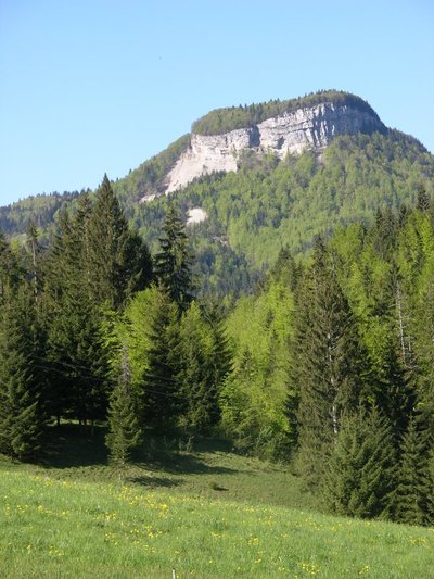
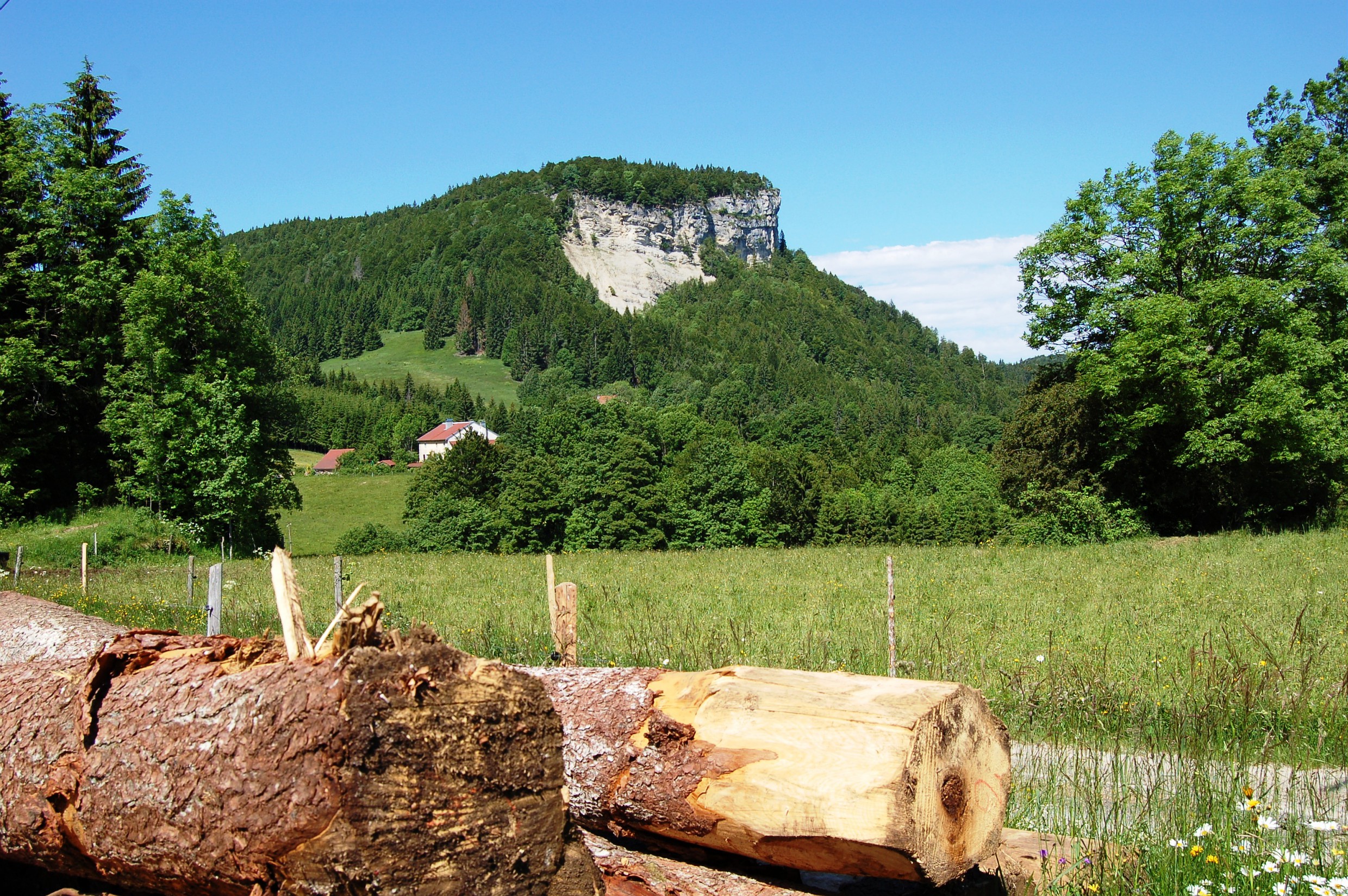
Mont Fiers - Gilles Prost - PNRHJ ViewpointViewpoint over Mont Fier
Mont Fier seems to defy the rules of morphology set by the Jura relief. By its very definition, a mountain is comprised of an anticline (a fold that is convex upwards) and a synclinal valley (a fold that is convex downwards). However, on observing the limestone strata that make up Mont Fier’s cliff, there are signs of a very shallow syncline. This rocky headland, isolated between two depressions, is the only example of a perched syncline in the Jura.
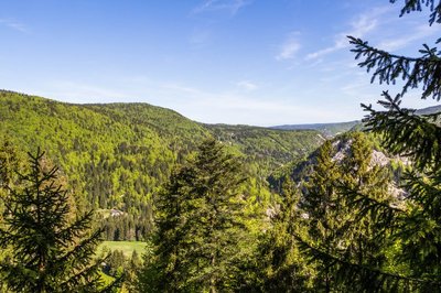
Belvédère des Maquisards - Nina Verjus - PNRHJ ViewpointBelvedere of the Maquisards
As its name indicates, this place pays tribute to the significant event having occurred at the end of the Second World War. In addition to the historical background provided by the interpretive sign on the site, this belvedere offers a wide panorama over the Morez wind gap.
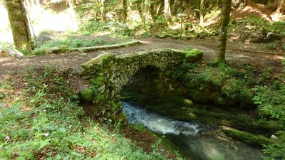
Pont de Perroud - Janin Jaouen - PNRHJ History & HeritagePerroud bridge
The old Perroud bridge, the waterfall and the ruins of the old mill are signs of just how much power the High-Jura needed to be able to grind, saw, and strike iron for example.
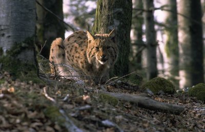
Le Lynx boréal - Claude Le Pennec FaunaThe Eurasian lynx
This emblematic feline needs a vast territory with a large forest massif. It certainly needs space: the female’s territory is close to 200 km²n and that of a male is closer to 400 km²! A solitary animal, male and female lynx only meet during mating season, from February to April.
Description
From the village centre, the trail heads up through the village (white and red waymarking) towards the Forebay of la Chaille via the D 25. At Abbé Barthelet, continue and follow the road to the left that descends to Prémanon d’Amont. After a steep descent, a forest path will lead you to the walkway over the Forebay of la Chaille.
- The waterfall can be reached within 10 mins to your right by following GR® 5, at the foot of a former mill.
The trail, that is rocky and muddy in some places, branches off to the left under the cover of forest to reach Sous le Saut and Le Bonzon.
Head down to the path to your left (yellow waymarking) until you reach PERROUD BRIDGE. Cross the recently restored bridge and head up a very steep trail. A narrow and steep trail to your left opens onto a gravel path and crosses over an intermittent stream. Head up to the right to Sur le Bief (house). The trail then turns right on a good path, crosses the D 25 and comes to Sur le Belvédère.
The BELVEDERE OF THE MAQUISARDS is 5 minutes away to your right across the D 25.
Returning to Sur le Belvédère, head opposite you up the old "route de Morez", towards Prémanon, with the Chez Jeankessis farms on your left.
Without ever changing direction, heading due south, follow a road for 150 m, and then a path for 400 m. The trail crosses another road behind the hamlet "Sur la truffe" before exiting onto the D 25 at the entrance of PREMANON.
- Departure : The centre of the village of Prémanon
- Arrival : The centre of the village of Prémanon
- Towns crossed : Premanon and Les Rousses
Forecast
Altimetric profile
Recommandations
Be careful around the gorges of Perroud bridge and on both occasions when crossing the D25.
This trail uses forest paths. To respect the owners and farmers granting you passage, and for the security of livestock and wild fauna, we ask that you remain on the waymarked paths. Use the adapted passageways to get across fencing and be sure to close gateways behind you.
Please keep your dog on a lead if you have one.
Wild flowers are beautiful, they may be rare and protected and often wilt quickly. Do not pick them! They will delight the next hikers.
In case of forest works (felling, skidding, etc.), for your safety, know when to stop and turn around.
Information desks

Tourist information centre - Station Les Rousses Haut-Jura
495 rue Pasteur Maison du Tourisme, 39220 Les Rousses
Transport
To visit and get about in the High-Jura, visit www.reshaut-jura.fr, the eco-mobility portal listing all means of transport within the Park.
Access and parking
4 km southeast of les Rousses via the N5 followed by the D 29 and the D 25.
Parking :
Report a problem or an error
If you have found an error on this page or if you have noticed any problems during your hike, please report them to us here:
Close by2
Laid-out site
Les Rousses fort
From the village of Les Rousses, there is no sign of a construction of this size. Both around the ramparts and from the centre of the Place d’Arme, the Les Rousses fort inspires curiosity and admiration.
Demilitarised and converted, the fort is now open to the public and can be discovered through various leisure activities.