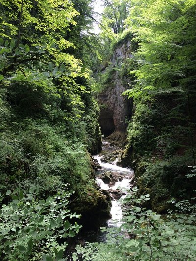
Gorges of the Saine and the Langouette
The waters' action is without a doubt one of the elements that contributes most towards the magical atmosphere of this place. Along this hike, discover the Saine in all its forms; the way it calmly flows along the bottom of a wide valley - setting a rhythm to your steps with its relaxing hum - before fiercely narrowing into a dark and thin bottleneck can be calmly contemplated from the tramline above. These are the gorges of Malvaux: tempestuous, untameable and wild. Their beauty is well worth the detour.
9 points of interest
Langouette - GTJ Lakes & RiversTrail of the gorges of the Langouette
Departing from the church, the Langouette faerie accompanies you on this trail marked by interpretive signs which will help you to reveal the secrets of the mysterious waterfalls and gorges of the Langouette, and to admire the wild beauty of this canyon carved by the Saine up-close.
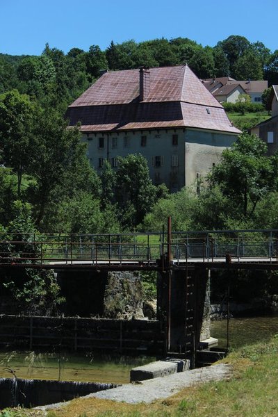
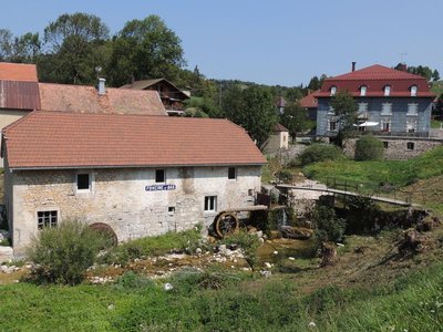
Ancien relais de diligence - Julien Vandelle History & HeritageFormer diligence relays
This imposing structure built in 1789, with a gambrel roof, also called a “Mansard” roof, is comprised of two stories of barns and two stories of cellars. Relays had to be able to accommodate a large number of hitches. For the Grandvallier “rollers” (road hauliers), who worked independently or on behalf of “rolling firms”, these relays were vital stop-offs. At the height of the rolling period, during the mid-19th century, rolling firms such as the famous Maison Bouvet established their own relays in major cities.
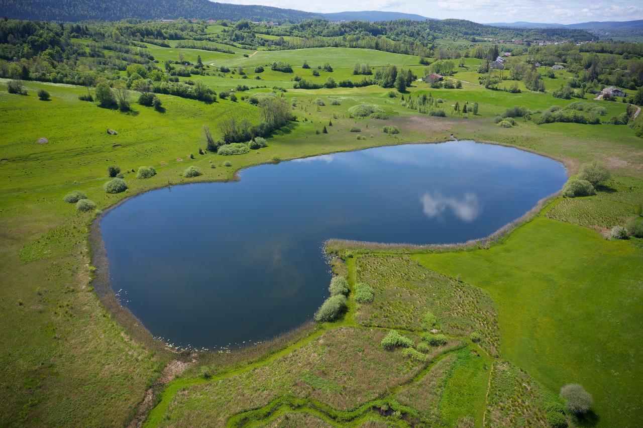
Lac à la dame - Nina Verjus - PNRHJ History & HeritageThe legend of the Lady of the lake
Lake countries are haunted by many legends: faeries, knights and witches float above their mysterious waters. Several legends serve as the origin of the name “Lac à la Dame” (the Lady’s lake). One legend states that this small lake was dug out by the mysterious knight that wanders over the lakes of Bonlieu, Maclu and Narlay, at the request of a woman he once loved. In exchange for this favour, she would give herself to him body and soul. During foggy weather, you might see the Lady’s long white dress floating over the lake!
Foncine-le-Bas - F. Jeanparis History & Heritage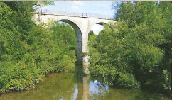
Viaduc des Douanets - Gilles Prost - PNRHJ History & HeritageThe Douanets Viaduct
Metric tracks were intended to avoid the need for works of art. However, in a rugged region, viaducts were the only way to cross rivers, chasms and precipices. The Clairvaux-Foncine line was in use from 1907 to 1939; its tracks were dismantled under the Occupation.
Voie du tram - Nina Verjus - PNRHJ History & HeritageThe Tram Line
At the start of the 20th century, the Jura mountain comprised 400 kilometres of metric railway lines completing the main general interest lines such as the Andelot-La-Cluse line. On these narrow lines, the “Tacot” carried both goods and people both in the summer and in the winter. The first connection - Lons-Saint-Claude - opened in 1898, Champagnole to Foncine-le-Bas through Planches-en-Montagne in 1924, before closing in 1950. Tacots were beneficiaries until 1927. Later, breakdowns, derailing and delays, as well as the rise of automobiles sealed the fate of the “little train” in 1958 with the closing of the Morez-les Rousses-La Cure line. In fifty years, through their exchanges and their work, tacots marked the memories of Jura inhabitants and contributed towards building a heritage similar to that of the viaducts of the gorges of Malvaux.
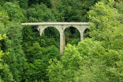
Cascade du Bief de la Ruine - Nina Verjus - PNRHJ WaterfallsWaterfall of the La Ruine forebay
Springing from a source at an altitude of over 1,000 metres, and only after heavy rainfall, the La Ruine forebay waterfall offers a harmonious spectacle that is a mix between the work of Man and the work of nature. The viaduct draws the eyes towards the dance of water on rock, which naturally creeps between the piers of the bridge.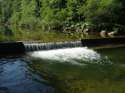
Impacts de seuils et continuité écologique - Bertrans Devillers - PNRHJ Lakes & RiversWeirs and ecological continuity
Many obstacles, weirs or dams, were long-ago built on the waterways to draw from their hydraulic power. Most of them are no longer used and still hinder the natural transportation of sediments from the river and the movement of fish.
Through lack of maintenance, these run a great risk of destabilising neighbouring infrastructures. Knowledge of how waterways work has also significantly improved, encouraging their managers to work towards a more natural operation of waterways, by installing or dismantling unused weirs.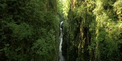
Les gorges de la Langouette - F. Jeanparis WaterfallsThe gorges of the Langouette
A source of legends and history, the gorges of the Langouette are full of beauty and stories waiting to be discovered.
Description
The trail meets up the FONCINE-LE-BAS crossroads and ascends to the right (yellow waymarking) via the Grand-Vie farm road (oratory, former tramline crossing) before reaching Les Fumey. The grassy path to your right crosses the D 62. The road then serves the Fumey hamlet and leads to the Lac à la Dame crossroads.
To your right, take the farm road uphill and follow along the Senge stream before fording the stream (pile of rocks). The trail skews off to the right into the forest (beautiful beech forest) and follows along a first clearing before descending towards the Cingernaux combe. Circumventing the combe, after a sharp turn, you will come to the D 127 in Malvaux (view onto the waterfalls of the la Ruine forebay). Cross the D 127, take the wide path below the road. Reach the LES-PLANCHES-EN-MONTAGNE WASHHOUSE by crossing the bridge over the Saine.
The trail (white and red waymarking) follows the Landouette Gorges Trail to the left, which opens out onto le Martinet.
The path then heads up the village following the road to the right (yellow waymarking) before reaching THE WASHHOUSE.
To the left, the path heads along the Washhouse road (white and red waymarking) before heading up the Saine's right embankment and reaching the Fumey Badoz Factory Canal.
To the right, the stony and shaded path (yellow waymarking) heads up the valley until it comes to the stream called la Pisse, which you will follow up to the left (passing under the viaduct) to reach Sous Bayard.
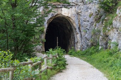
The path heads up (white and red waymarking) the gorges of Malvaux, with a short section in the dark tunnel until it reaches the Douanets Viaduct. Cross the viaduct (yellow waymarking) to return to your starting point at the Champ de Mars.
- Departure : Champs de Mars, Foncine-le-Bas
- Arrival : Champs de Mars, Foncine-le-Bas
- Towns crossed : Les Planches-En-Montagne and Foncine-Le-Bas
Forecast
Altimetric profile
Sensitive areas
- Impacted practices:
- Aquatic,
- Sensitivity periods:
- JanFebMarAprMayJunJulAugSepOctNovDec
- Contact:
- Parc naturel régional du Haut-Jura
29 Le Village
39310 Lajoux
03 84 34 12 30
www.parc-haut-jura.fr/
- Impacted practices:
- Aquatic,
- Sensitivity periods:
- JanFebMarAprMayJunJulAugSepOctNovDec
- Contact:
- DREAL Bourgogne-Franche-Comté
Cité administrative VIOTTE
5 voie Gisèle Halimi - BP 31269
25005 BESANÇON CEDEX
Tél : 03 39 59 62 00
Recommandations
Be careful during the 10 m crossing through the dark tunnel.
This trail passes through pastures with livestock and forest paths. To respect the owners and farmers granting you passage, and for the security of livestock and wild fauna, we ask that you remain on the waymarked paths.
Use the adapted passageways to get across fencing and be sure to close gateways behind you.
Please keep your dog on a lead if you have one.
Wild flowers are beautiful, they may be rare and protected and often wilt quickly. Do not pick them! They will delight the next hikers.
In case of forest works (felling, skidding, etc.), for your safety, know when to stop and turn around.
Information desks

Tourist information centre - Foncine-le-Haut
60 Grande Rue, 39460 Foncine-le-Haut
Transport
To visit and get about in the High-Jura, visit www.reshaut-jura.fr, the eco-mobility portal listing all means of transport within the Park.
Access and parking
12 km north of Saint-Laurent-en-Grandvaux via the D 437 and 4 km south of Foncine-le-Haut via the D 437.
Parking :
Report a problem or an error
If you have found an error on this page or if you have noticed any problems during your hike, please report them to us here: