The Saine's source trail
1 point of interest
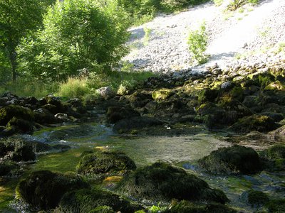
Source de la Saine - PNRHJ / Gilles Prost Lakes & RiversThe source of the Saine, a karst spring
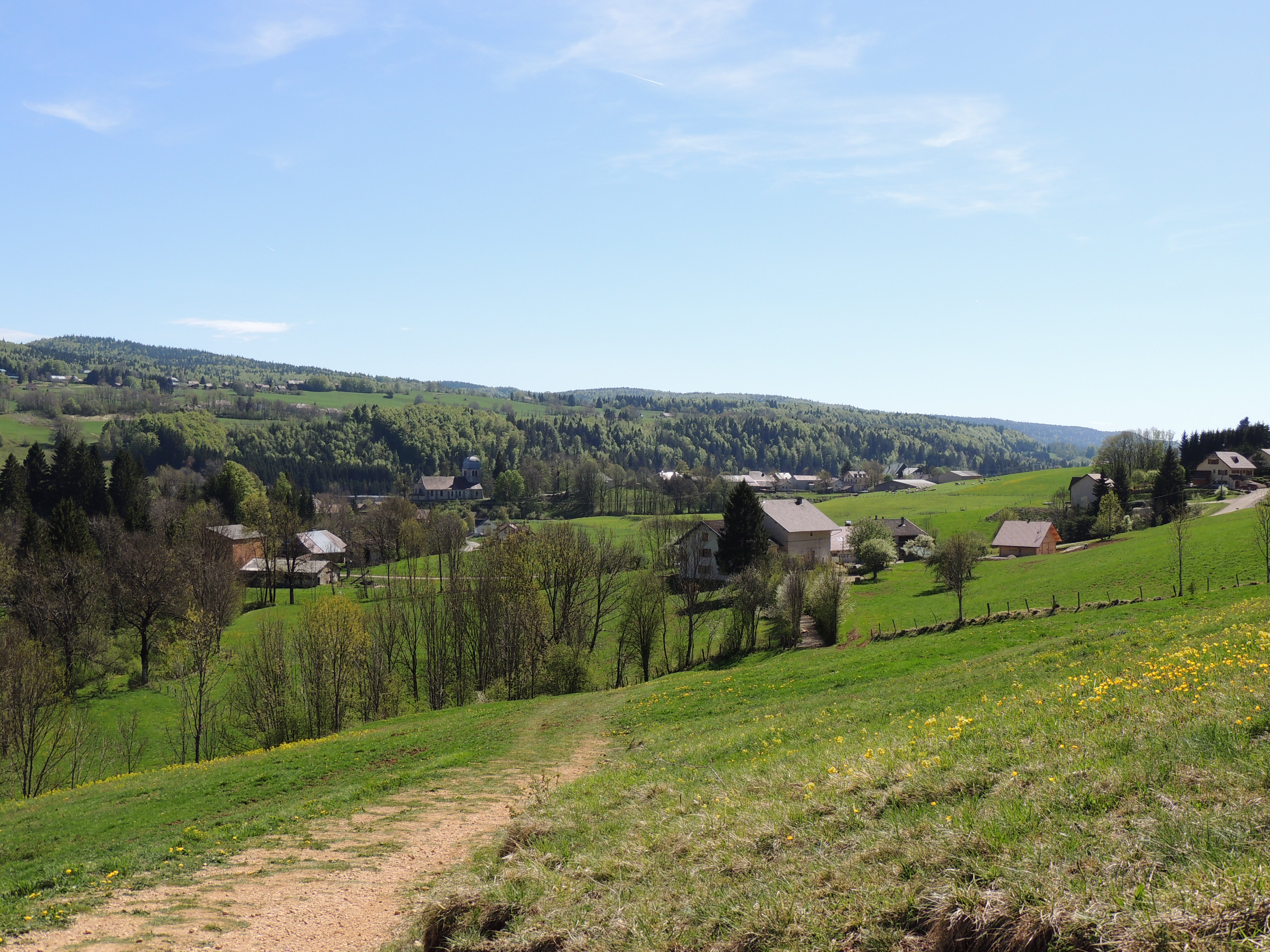
The Saine, or formerly the “Sène” springs from an intimate location at the foot of a rocky amphitheatre under the eastern slope of the Croz Mont mountain forest. Its waters have travelled a long way underground through galleries that have been carved over time into the limestone. Its flow rate varies, not according to the rainfall on that day or the previous day, but according to the rainfall having occurred several days before over the massif. The source once sprung from much higher up in the rocky fault. Today, it only uses these old exits during times of high flow rates. Above Foncine-le-Bas, the flood and temporary waters of the Creux des Joyaux are said to occur due to excess waters in the Saine’s underground reserves.
Description
- The Saine's source in its landscape
- The low wall, between municipal and good lands
- From stone to water
- Faults and chasms
- Stone knives honed by the water
- Departure : Chez Vallet, Foncine-le-Haut
- Arrival : Chez Vallet, Foncine-le-Haut
- Towns crossed : Foncine-Le-Haut
Forecast
Recommandations
This trail passes through pastures with livestock and forest paths. To respect the owners and farmers granting you passage, and for the security of livestock and wild fauna, we ask that you remain on the waymarked paths.
Use the adapted passageways to get across fencing and be sure to close gateways behind you. Lastly, please keep your dog on a lead if you have one.
Wild flowers are beautiful, they may be rare and protected and often wilt quickly. Do not pick them! They will delight the next hikers.
In case of forest works (felling, skidding, etc.), for your safety, know when to stop and turn around.
Information desks

Tourist information centre - Foncine-le-Haut
60 Grande Rue, 39460 Foncine-le-Haut
Transport
To visit and get about in the High-Jura, visit www.reshaut-jura.fr, the eco-mobility portal listing all means of transport within the Park.
Access and parking
Parking :
More information
Report a problem or an error
If you have found an error on this page or if you have noticed any problems during your hike, please report them to us here:
Close by1
- Services
Services
CNJ Tourisme - Foncine-le-Haut
The Jura Monts Rivière tourist office was created in 2004 by bringing together the Champagnole tourist office and that of the Pays de Haute Joux Mont Noir. Its reception offices and its dynamic, available and attentive team were maintained in Champagnole, Nozeroy and Foncine.