Grandvaux, Malvaux au fil de l'eau
A journey to the heart of water... From lakes to caves, waterfalls and majestic landscapes... Discover the hidden treasures of this course dedicated to water and geology. Cross the ages, take a leap from the traces of the glaciers of the Quaternary era, to the life animated today by the fauna of preserved natural sites.
This Jurassic Velo Tours route has digital guidance only. You will not find any markings on the ground. Let yourself be guided with the Jurassic Vélo Tours app, which can be downloaded for free from Google Play Store and App Store. As you go along, signposts will indicate points of interest to discover.
Be careful ! Given the crossing of a relatively long old railway tunnel and the duration of the journey, plan a lamp or lighting as well as a backup battery....
19 points of interest
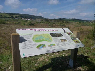
Le belvédère du Chatelet - Lakes & RiversBelvedere of Le Chatelet
Here, the Lemme and its tributaries were subject to major ecological restoration works in 2012 to allow the marsh in Le Chatelet to regain its role as a natural waterway regulator.
An interpretive sign explains which malfunctions had appeared due to previous developments, presents which restoration works were carried out and their advantages, and lists a few wildlife and plant species that live in this environment.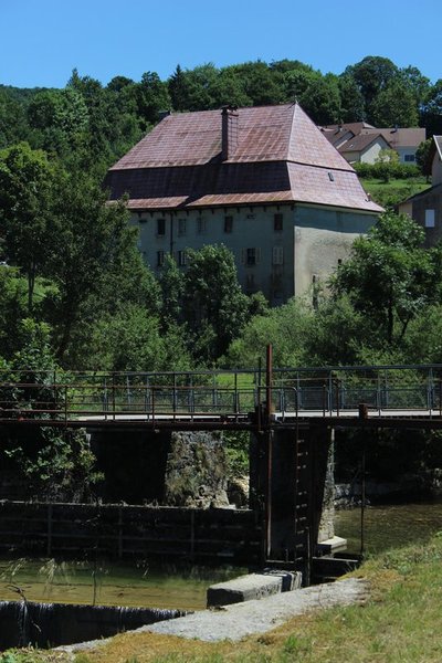
Ancien relais de diligence - Julien Vandelle History & HeritageFormer diligence relays
This imposing structure built in 1789, with a gambrel roof, also called a “Mansard” roof, is comprised of two stories of barns and two stories of cellars. Relays had to be able to accommodate a large number of hitches. For the Grandvallier “rollers” (road hauliers), who worked independently or on behalf of “rolling firms”, these relays were vital stop-offs. At the height of the rolling period, during the mid-19th century, rolling firms such as the famous Maison Bouvet established their own relays in major cities.
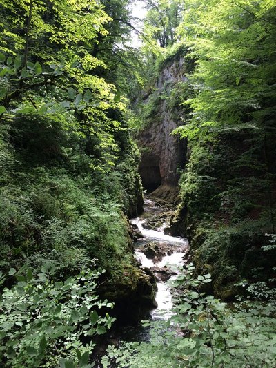
Langouette - GTJ Lakes & RiversTrail of the gorges of the Langouette
Departing from the church, the Langouette faerie accompanies you on this trail marked by interpretive signs which will help you to reveal the secrets of the mysterious waterfalls and gorges of the Langouette, and to admire the wild beauty of this canyon carved by the Saine up-close.
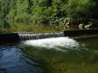
Impacts de seuils et continuité écologique - Bertrans Devillers - PNRHJ Lakes & RiversWeirs and ecological continuity
Many obstacles, weirs or dams, were long-ago built on the waterways to draw from their hydraulic power. Most of them are no longer used and still hinder the natural transportation of sediments from the river and the movement of fish.
Through lack of maintenance, these run a great risk of destabilising neighbouring infrastructures. Knowledge of how waterways work has also significantly improved, encouraging their managers to work towards a more natural operation of waterways, by installing or dismantling unused weirs.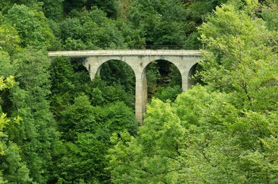
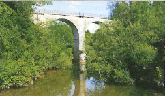
Cascade du Bief de la Ruine - Nina Verjus - PNRHJ WaterfallsWaterfall of the La Ruine forebay
Springing from a source at an altitude of over 1,000 metres, and only after heavy rainfall, the La Ruine forebay waterfall offers a harmonious spectacle that is a mix between the work of Man and the work of nature. The viaduct draws the eyes towards the dance of water on rock, which naturally creeps between the piers of the bridge.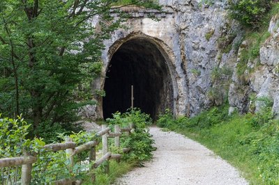
Voie du tram - Nina Verjus - PNRHJ History & HeritageThe Tram Line
At the start of the 20th century, the Jura mountain comprised 400 kilometres of metric railway lines completing the main general interest lines such as the Andelot-La-Cluse line. On these narrow lines, the “Tacot” carried both goods and people both in the summer and in the winter. The first connection - Lons-Saint-Claude - opened in 1898, Champagnole to Foncine-le-Bas through Planches-en-Montagne in 1924, before closing in 1950. Tacots were beneficiaries until 1927. Later, breakdowns, derailing and delays, as well as the rise of automobiles sealed the fate of the “little train” in 1958 with the closing of the Morez-les Rousses-La Cure line. In fifty years, through their exchanges and their work, tacots marked the memories of Jura inhabitants and contributed towards building a heritage similar to that of the viaducts of the gorges of Malvaux.
Viaduc des Douanets - Gilles Prost - PNRHJ History & HeritageThe Douanets Viaduct
Metric tracks were intended to avoid the need for works of art. However, in a rugged region, viaducts were the only way to cross rivers, chasms and precipices. The Clairvaux-Foncine line was in use from 1907 to 1939; its tracks were dismantled under the Occupation.
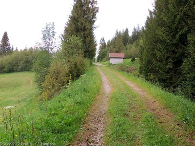
Foncine-le-Bas - F. Jeanparis History & Heritage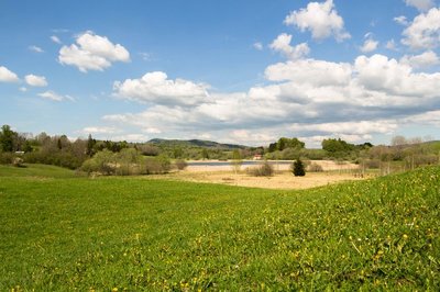
Lac à la dame - Nina Verjus - PNRHJ History & HeritageThe legend of the Lady of the lake
Lake countries are haunted by many legends: faeries, knights and witches float above their mysterious waters. Several legends serve as the origin of the name “Lac à la Dame” (the Lady’s lake). One legend states that this small lake was dug out by the mysterious knight that wanders over the lakes of Bonlieu, Maclu and Narlay, at the request of a woman he once loved. In exchange for this favour, she would give herself to him body and soul. During foggy weather, you might see the Lady’s long white dress floating over the lake!
 History & Heritage
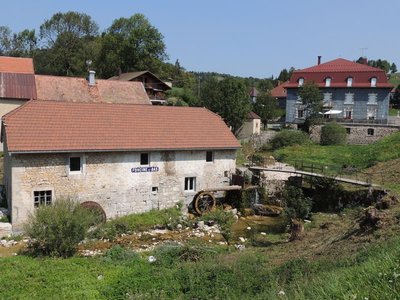
The Chalet “larmiers”
Used to air dairy products and a room where milk was stored to cool before being turned into cheese, “larmiers” are narrow and long vertical openings that can be seen on the facades of former cheese dairies like here in Les Monnets.
In the hamlet of Coin d’Aval, in the municipality of Fort-du-Plasne, you can visit an old chalet (or cheese dairy).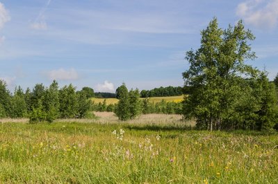
Tourbière de Fort-du-Plasne - Nina Verjus - PNRHJ Natural environmentsThe peat bog: a carbon well
The need to protect peat bogs is a recent revelation. These fragile environments play an important role in maintaining water quality and in naturally combatting the effects of drought and climate change. Plants absorb carbon dioxide (CO2) from the air by photosynthesis to form their tissue: leaves, trunk, stems, etc. When they die, they are decomposed by microorganisms in the ground and return the carbon into the air. But in a peat bog, the presence of water prevents decomposing organisms from working, which traps the carbon in the peat. Peat bogs only represent 3% of the surface of emerged land, but they store 30% of the Earth soils’ carbon!
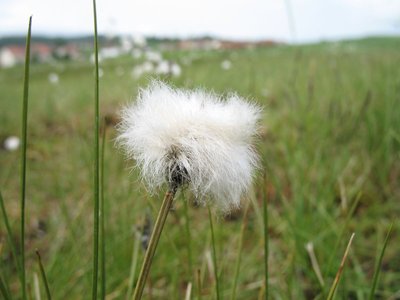
Linaigrette - Pierre Levisse - PNRHJ FloraCotton grass
Cotton grass, resembling a cotton bud with a white feathered end, is easily recognisable in peat bogs. Its meter-long roots enable it to store nutritional reserves, as the ground is very low in minerals. It’s a plant that is suited to a northern climate (cold). It was widespread across Europe a few thousand years ago. However, the climate subsequently grew warmer and it only survived in Scandinavian countries and in peat bogs, where no other plant is able to replace it.
Tourbière de Fort-du-Plasne - Nina Verjus - PNRHJ FloraCharacteristics of the flora in peat bogs
The species living in peat bogs have adapted to the omnipresence of water, to few nutritional resources, to the chemical composition of the soil - which, in calcareous regions, can be acid or basic - and to a rather cold climate.
La voie du tram - OT Grandvaux History & HeritageThe Tram Line
The tram line you are on was opened in 1907. It passed through Lac des Rouges Truites and linked Clairvaux-les-Lacs to Foncine-le-Haut and served Saint-Laurent-en-Grandvaux.
Like all Jura tram lines, due to lack of profit and competition from the development of bus services and automobiles, it closed in 1938.
Will you be able to find the old station in the hamlet of Thévenins on returning to Bugnon?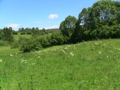
A.RULLIER Natural environmentsWet meadow
Here, the peripheries of peat bogs are still grazed on. These wet meadows, which are characterised by the presence of a large amount of water in the soil, are also very rich for biodiversity. Some flowers, such as the bird’s-eye primrose, particularly flourish here.
These are also areas of transition between the rest of the valley and the peat bog, and between the lake and the river. They filter water through the soil, eliminating nitrate, which limits the pollution of groundwater. Their presence is therefore vital to properly maintain a peat bog.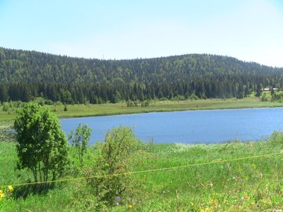
Le lac du Lac-des-Rouges-Truites - A.RULLIER History & HeritageThe mystery of Les Rouges Truites
The High-Jura is a land of many legends that likes to keep its secrets.
Rumour has resulted in four different version relating the origin of the name Lac des Rouges Truites:- Poetic: every evening, when the sun sets, trout take on a crimson hue due to the rays’ reflection on the lake.
- Practical: the trout are salmon trout.
- Physical: the water is said to contain iron oxide.
- Military: the lake is said to have been the site of a bloody battle.
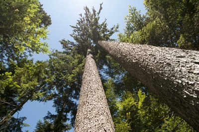
La forêt du Mont Noir - FloraMont Noir forest
Spread across 1873 hectares, the Mont Noir massif is one of the largest Jura forests. It is currently made up of dark-leaved trees, such as fir, spruce and beechwood, hence its name. Stags, boar and roe deer live here alongside the lynx and the western capercaillie. Wood exploitation is an important economic activity for our mountains. However, the forest also accommodates hikers wishing to take long works on the waymarked paths, both during summer and winter. Share this area and be careful if you come across forest works.
%20PNRHJ%20-%20F.%20Jeanparis.jpg.400x0_q85.jpg)
Vue sur la tourbière du lac des Rouges Truites - F. Jeanparis Natural environmentsView over the lac des Rouges Truites peat bog
Inherited from the icebergs which covered the Jura ten thousand years ago and left behind moraines with water-tight bottoms, a peat bog formed from the accumulation of stagnant water full of cold-resistant plants. The moving soil in peat bogs are made up of a thick carpet of peat moss, on which a few well-adjusted plants are able to grow (cranberry, cottongrass, andromeda, drosera, mountain pine, etc.) These fragile environments are of biological interest and must therefore be preserved.
Voie du tram - F. Jeanparis History & HeritageTram Line
At the start of the 20th century, the Jura mountain was equipped with 400 kilometres of metric railway lines completing the main general interest lines such as the Andelot-La-Cluse line.
Winding between the rivers, chasms, precipices and ridges, the tram lines marked the Jura’s history and its landscape with their often-spectacular developments and infrastructures such as the Douanets viaduct in Foncine-le-Bas.
Description
From the tourist office, go up Rue de Genève on your left then turn twice on your right to take Rue du Coin d'Amont, behind the church and follow it to the end. After leaving the village, take the footbridge over the N5 and continue on the same paved forest road to the hamlet Vers les Moulins.
Cross the bridge over the Lemme then turn left.
At the ruins of the Moulin d'Hylarion, continue on the road and reach the Châtelet (former holiday center which is now a school).
At the crossroads after the school, turn left then after 300 m, take a small path to the right, direction Chez Mayet.
In the hamlet "les Gros Louis" (indicated "le Saut" on the IGN map), turn right twice. At the cross road, go left and find the N5.
In front of you is a former hotel-restaurant on the edge of which a platform has been set up with a beautiful view of the Lemma.
Follow the N5 to the left, pass the Lemme, quickly reach the old restaurant "Le Pont Romain" and a forest road to the right.
Turn right on the forest road, temporarily overhang the railway line then cross the forest until you approach the Prélet forest hut.
Turn at an acute angle to the right onto the Route Forestière du Lignon.
Cross the Dombief, take the first road on the left and reach the hamlet of La Boissière.
Cross the village then, before the hamlet of Rollets, continue to the right on the Route Forestière du Bois de Ban, to the parking lot of the Belvédère des Quatre Lacs.
A path on the left gives access to the viewpoint of the Four Lakes and the Pic de l'Aigle. Continue on the forest road. At the next crossroads, turn left and reach the N5 at the hamlet of Cernois.
Go left then turn right in front of the isolated farm, at the foot of the Falaise du Rachet, climbing site of the Morillon.
Continue on the road on the left, along the Lemme, to the Pont de la Chaux. Pass the station and the restaurant, carefully cross the D16 and take the municipal road opposite. Join the hamlet La Tépette.
Take the lanes parallel to the D16, Rue de la Tepette then Route du Chavon, to arrive at the entrance to the village of Chaux-des-Crotenay.
Go up the Grande Rue to the left, and follow the 2nd right, Route d'Entre-deux-Monts, to below the village.
200 m before the church, take the wide white path on the left which allows you to cross the valley and reach the intersection with the D16.
Cross the road with caution, follow the D127E1 for a few meters and take the path to the right. Descend through the forest then a pasture before finding the road.
Go right, Rue de la Langouette then follow the direction of the Gorges de la Langouette on the right. Cross a street and take, just before the Montliboz agglomeration exit sign, the Chemin des Cascades on the right. Join the Planches-en-Montagne
Turn left in front of the cemetery, cross the bridge over the Saine and walk along the church.
Just after this, at the directional post "Les Planches-en-Montagne", follow the Ruelle du Lavoir on the right, White/Red markings, direction Foncine-le-Bas. Continue along the tram line, an old railway line, with the Saine on your right.
Observe on the left the Cascade du Bief de la Ruine and cross a tunnel in an arc of a circle, bring a light. Continue along the Saine.
At the arrival of the tram line, cross the bridge then join Foncine-le-Bas.
Take the Route de Champagnole to the right for 150 m then cross it to turn left onto the D62, direction Fort-du-Plasne. Join the first paved road on the right.
Follow this one, Chemin du Lac de la Dame, towards Les Fumey. Bypass the Lac à la Dame and then go up again on the D62.
Continue on this one and reach the village of Fort-du-Plasme.
Take the road on the left just before the first houses in the village. Ride between Fort-du-Plasne lake and its wetland.
At Les Voigneurs hamlet, turn right and follow the road to Le Maréchet hamlet.
Turn right on the D437 then take the first paved road on the left. Cross the small bridge and at the directional post for hiking "le Maréchet", follow the path to the right, yellow markings in the direction of "la Gare". Go straight at each fork and reach the D437.
Go left, pass the Lac-des-Rouges-Truites agglomeration entrance sign and walk along the old station building on your left.
Just after this, leave the D437 and take the secondary road on the left. Keep left until Domaine du Bugnon. Possibility to take a break, have a drink or recharge a battery.
Continue on the same forest road until the crossroads with four roads, hiking post "Les Quatre Chemins".
Continue to the right, follow the yellow markings and reach a housing estate via a forest road. Pass it a few meters and find the start of the old tram line on the left, currently the white path.
Follow this one and continue straight at each fork.
At the exit of the tram lane, a few meters before the D437, opposite the "La Halte des Martins" post, turn left and stay on the grassy path parallel to the road. Pass, on the right, the old railway stop and find a small paved road to take, opposite, for a few tens of meters.
At the intersection, go straight then quickly turn right, Chemin du Carlaton (limited to 3.5t). Join the hamlet of La Savine and the N5.
Cross the N5 via an underpass on the right. Opposite the fountain, take the middle white path which starts between the Route des Gyps and the Chemin sous la Savine. The tram line leads to the Pésières district in Saint-Laurent en Grandvaux
At the intersection with Rue des Pésières, turn right and drive to Rue de Genève.
Turn left and go up Rue de Genève by the cycle lane on the sidewalk, to the Tourist Office.
- Departure : Saint-Laurent en Grandvaux
- Arrival : Saint-Laurent en Grandvaux
- Towns crossed : Saint-Laurent-En-Grandvaux, Lac-Des-Rouges-Truites, Fort-Du-Plasne, La Chaumusse, La Chaux-Du-Dombief, Entre-Deux-Monts, Les Planches-En-Montagne, and Foncine-Le-Bas
Forecast
Altimetric profile
Sensitive areas
- Impacted practices:
- Aquatic,
- Sensitivity periods:
- JanFebMarAprMayJunJulAugSepOctNovDec
- Contact:
- Parc naturel régional du Haut-Jura
29 Le Village
39310 Lajoux
03 84 34 12 30
www.parc-haut-jura.fr/
- Impacted practices:
- Aquatic,
- Sensitivity periods:
- JanFebMarAprMayJunJulAugSepOctNovDec
- Contact:
- DREAL Bourgogne-Franche-Comté
Cité administrative VIOTTE
5 voie Gisèle Halimi - BP 31269
25005 BESANÇON CEDEX
Tél : 03 39 59 62 00
Access and parking
Parking place behind the tourist information center.
Report a problem or an error
If you have found an error on this page or if you have noticed any problems during your hike, please report them to us here:
Close by2
Laid-out site
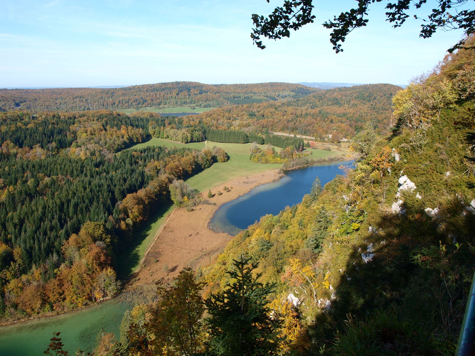
Belvedere of the Pic de l’Aigle (Eagle’s peak)
On the windy top of the Pic de l’Aigle, the landscape is yours to admire. To the west, the two main plateaus that mark the start of the Jura’s relief stretch out before you. The rocky ledge where the Pic de l’Aigle culminates and the lake region mark a break with the relief’s third plateau which is located to the east and gives way to the folded structures of the Jura’s high valleys.