The five fountains
Each ascent, whether steep, technical or winding, will be rewarded by the beauty of a viewpoint, a village, a natural environment or a invigorating descent.
10 points of interest
Ancienne tournerie Montcusel - PNRHJ / Roman Charpentier History & HeritageOld wood-turning factory
These “municipal” wood turning factories, built by the Union Électrique (electricity union), were used for rural production, but were also important social locations, particularly during the winter period. Several members of one family could rent a wood-turning space in the workshop, pooling their production for sale to the Moirans traders. According to some authors, municipal workshops weren’t used by specialised craftsmen, who preferred to protect their manufacturing secrets for specific markets. Spaces in the wood-turning workshop were mostly beneficial to farmers who could use them to earn additional income without any investment costs (C. Picod, 1991).
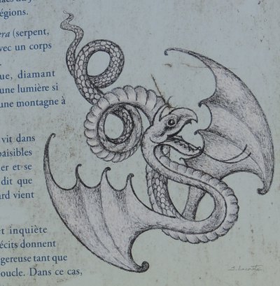
PNRHJ / F. JEANPARIS - F. JEANPARIS History & HeritageLa Vouivre
“It spoke with a young and resounding voice, with a Jura accent with wide open vowels, clear like a white loaf in which consonants take a decisive bite. [...] The Vouivre flat on its stomach in a bed of reeds, bathing in the sun with a bare bottom and its ruby dress alongside it, indeed.” This is how Marcel Aymé, an author from Franche-Comté, described the Vouivre in his book of the same name;
The Vouivre is usually described like a winged, flamboyant serpent with a garnet as its only eye, a fabulous diamond whose value, beauty and power is equalled only by the lust that it arouses in men. Often associated with desire, the Vouivre is also represented as a half-woman, half-serpent. Legend says that the creature only left its treasure to bask in the calm waters of the humid Jura environments. But beware of still waters... we don’t recommend attempting to steal its garnet!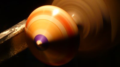
Toupie - (PNRHJ / A.HUGUES) History & HeritageThe “Bimbeloterie”
“Bimbeloterie” is the French term used to define the trade of all sorts of wood-turned trinkets: spinning tops, cases, taps, jumping rope handles, ornaments, etc.
Nearly every home still has a few old specimens once made by parents or grandparents in the family workshop. Space consuming and often of little use, they are full of ancient know-how which makes them so difficult to get rid of.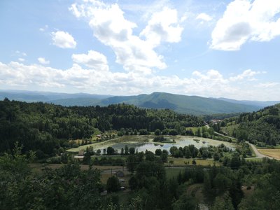
Vue depuis le belvédère des Trois Escaliers - PNRHJ - F. Jeanparis ViewpointBelvedere of the Three Stairs
This 500-meter out-and-back is accessible to mountain bikes and offers a stunning view over the Lac de Chanon and the vast folded Jura all the way to the Jura Mountains, with illustrations and explanations provided by interpretive signposts.
PNRHJ / F. JEANPARIS - F.JEANPARIS History & HeritageThe Vouglans dam
Built on the Ain in 1968, at 130 metres high, the Vouglans dam is the French dam with the 3rd highest storage capacity: it is capable of holding around 600 million cubic metres of water, and with 1600 hectares of water surface, it makes the Vouglans lake one of the largest artificial lakes in France. It took a year and a half to fill with water and it deeply changed the physiognomy of the Ain’s embankments, swallowing up several hamlets as well as the Chartreuse de Vaucluse, the first Carthusian monastery in the Jura (12th century).
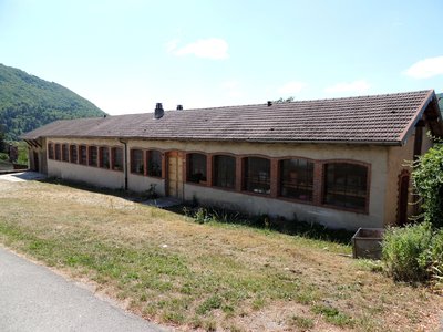
Ancien atelier - PNRHJ - F. Jeanparis History & HeritageThe “Union électrique”
With significant facilities in the gorges of the Ain (Saut Mortier I, 1901 and Saut Mortier II, 1912), the Franche-Comté company, Union électrique (1897-1946), led an electricity supply network in rural municipalities and enabled craftsmanship in the region of Saint-Claude (R. Tardy, 2003). In the département of Ain, it developed two major lines providing electricity to the municipalities having sold it the land. Even better, it built industrial buildings in return for the land used to place electricity lines, in which craftsmen could rent driving power to run their towers. (PNRHJ - Collection patrimoine, “Heritage collection”)
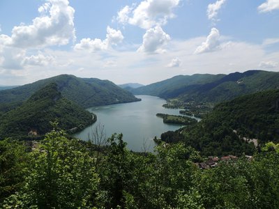
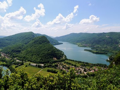
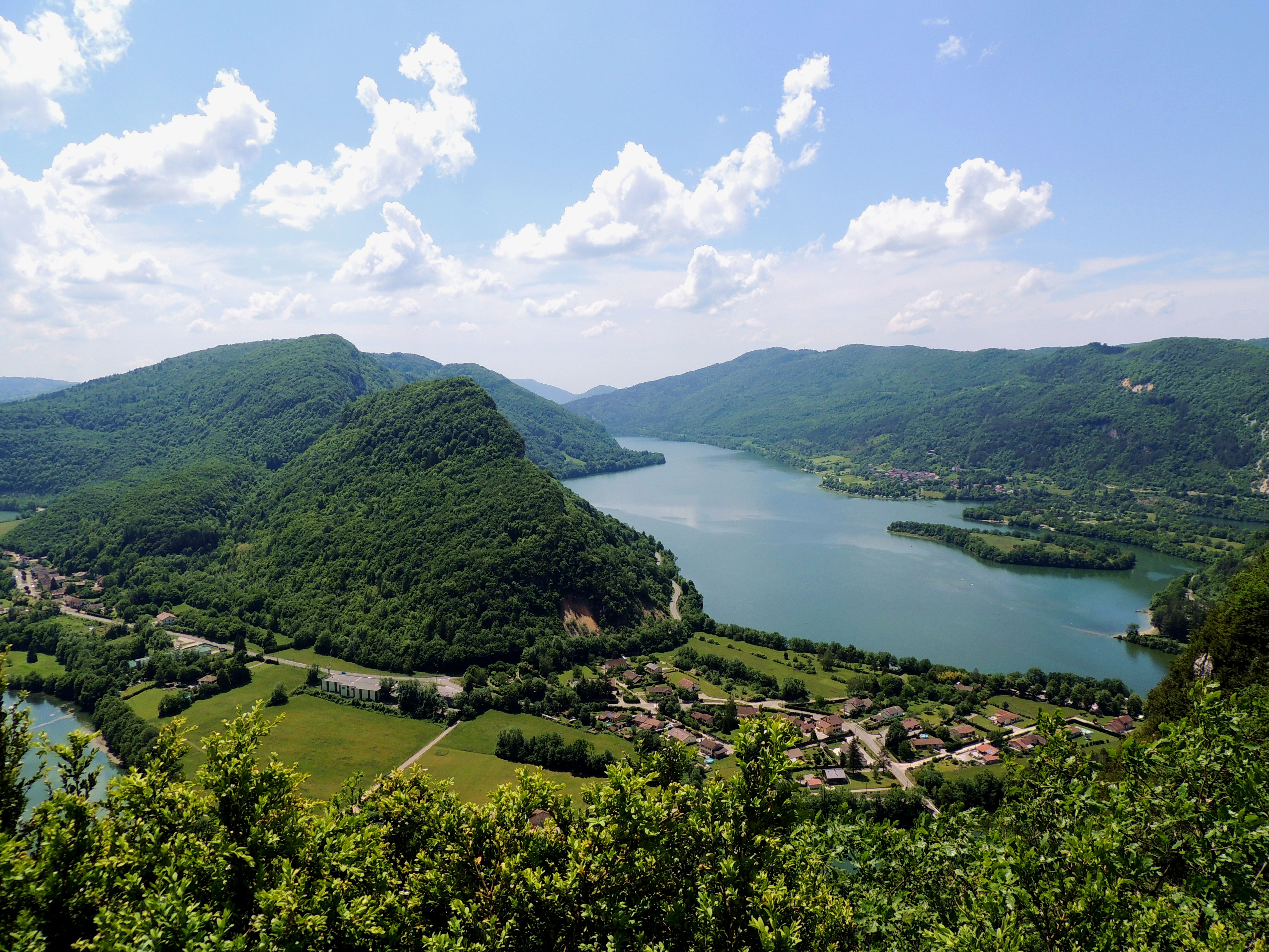
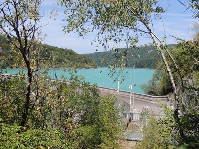
Vue sur le lac de Coiselet - PNRHJ - F. Jeanparis ViewpointLe Chanais Belvedere
Take time to appreciate the view: the Lac de Coiselet, created by a dam built in 1970, collects the water from the Bienne and the Ain and winds along the bottom of a distinct relief.
With a bit of patience, you may see some of the birds of prey that nest in the nearby cliffs.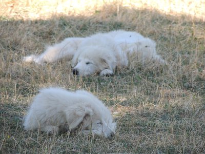
Patous - PNRHJ - F. Jeanparis Pastoralism and agricultureThe Patou dog, cattle protector
From birth, the Patou dog lives alongside sheep in the sheep-pen, which allows it to build a strong relationship with the herd. The Patou’s role is not to shepherd the herd, but rather to protect it from predator attacks (wild animals, stray dogs, etc.). Its presence and its large size prevent many attacks. The dog’s first reaction is to bark and to place itself between the intruder or intruders and the herd. If the intruders do not heed this warning, the dog may then launch a physical attack.
(view the Advice and Recommendations page to learn how to behave in the presence of a protection dog.)
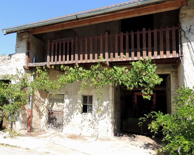
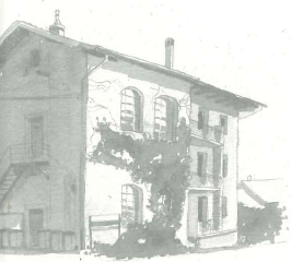
Maison à galerie - PNRHJ - F. Jeanparis History & HeritageHouses with galleries
Balconies, or galleries, which partly or completely span the length of the first floor on the farm’s facade, essentially served for drying: here, people would store wood, corn, nuts, etc., sheltered by the protruding roof called a “souleret”. Seen from the road, the railings and pillars were sometimes covered in ornate decorations.
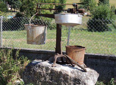
Ancien pèse-lait - PNRHJ - F. Jeanparis History & HeritageOld lactometer
Note the old lactometer visible at the junction of the two roads in Nezan. Livestock breeders and dairy producers working together under cooperatives would bring their production to the shared dairy (“fruitière”) in the morning and the evening to transform it into cheese and to mature.
The milk was weighed using this object to calculate their production, paid for based on weight and quality (pureness, fat content, dry weight, etc.), and not based on the number of litres.
Description
From MONTCUSEL (Black MTB waymarking no. 56), head down the main road towards MARTIGNA and up the D 295 for 800 metres.
Leave the D 295 and follow a small road to your left for 100 m before turning right onto an earthy path through the forest until you reach La Meille.
Follow the stony path to your right downhill, staying in the forest, and you will reach “Chemin de Cruzille”.
Continue straight on the downhill path to reach a good path, follow this path to the right until you come to Côte de Venière.
(Possibility of taking the 2 km tour of the Chanon lake to your right.)
From Côte de Venière, head up the D 295 to your left through a landscape that opens onto the Chanon Lake towards the village of MARTIGNA. On arriving at the hamlet of Le Chalet, at the foot of the village, take the path to your left overlooking the road and head to Chemin des Buis. Take the stony path to your left towards Aux Enfingues.
(Possibility of taking a round trip to the THREE STRAIRS BELVEDERE (BELVÉDÈRE DES 3 ESCALIERS) 400 metres away: viewpoint over Chanon lake and the outstretched Jura mountains).
Continue on the stony and earthy forest path towards the BELVEDERE OF BIEF DESSOUS (BELVÉDÈRE DU BIEF DESSOUS), which ascends slightly for 1.5 km, before heading back down to the D 299. Follow the road to your right until you reach the BELVEDERE OF BIEF DESSOUS.
Follow the forest path to your left towards Sur Faucon, and then turn left again to reach Les Cornes de Dolan.
Head down the stony trail to your left that will lead you to Grange des Plans, and continue right on the winding and steep path to Bois sous Faucon.
(Possibility of taking a 1-km round trip to the Les Plans beach on the edge of the Vouglans lake.)
Continue on the path to your left until you reach the EAST VOUGLANS DAM (BARRAGE DE VOUGLANS EST) and then take the road to the village of VOUGLANS. Head down “rue de Framboise” and then follow the D 299 for 50 m. Turn left onto “rue le Bourdia” to reach Le Bourdia.
Continue your journey towards CHANCIA through La Planche on a long stony path bordered by fields before a stretch in the shade along the Ain river until you reach Sur l’Antenne and later Sur Valière, before arriving at Sur la Cize, at the entrance to Chancia.
Take “Chemin de Nezan” to your left, which ascends sharply with two large bends and heads past Vers la Serra, A la Serra, and will take you to BELEVEDERE AU CHANAIS.
The stony path heads up to the Source Saumur before heading through pastures to the hamlet of NEZAN. Take the tarmac road up towards MONTCUSEL. Continue past the summit and take the narrow (single) stony path to your left 50 meters further on to head back down to your point of departure.
- Departure : Montcusel
- Arrival : Montcusel
- Towns crossed : Montcusel, Lect, Martigna, and Chancia
Forecast
Altimetric profile
Sensitive areas
- Impacted practices:
- Aquatic,
- Sensitivity periods:
- JanFebMarAprMayJunJulAugSepOctNovDec
- Contact:
- DREAL Bourgogne-Franche-Comté
Cité administrative VIOTTE
5 voie Gisèle Halimi - BP 31269
25005 BESANÇON CEDEX
Tél : 03 39 59 62 00
Recommandations
For an MTB outing, wear a helmet and bring enough water.
Paths are shared with pedestrians and horse riders, who have priority, therefore, please adapt and control your speed.
To use MTB paths, do not hesitate to get down from your bike.
This trail passes through pastures and forest paths. To respect the owners and farmers granting you passage, and for the security of livestock and wild fauna, we ask that you remain on the waymarked paths and close gates behind you where there are no MTB paths.
Wild flowers are beautiful, they may be rare and protected and often wilt quickly. Do not pick them! They will delight the next admirers.
In case of forest works (felling, skidding, etc.), for your safety, know when to stop and turn around.
Information desks
Tourist information centre - Jura Sud
3 bis rue du Murgin, 39260 Moirans-en-Montagne
Transport
To visit and get about in the High-Jura, visit www.reshaut-jura.fr, the eco-mobility portal listing all means of transport within the Park.
Access and parking
12 km south of Moirans-en-Montagne, Montcusel is accessible via the D 299 and the D 295 through Martigna.
Parking :
Report a problem or an error
If you have found an error on this page or if you have noticed any problems during your hike, please report them to us here:
Close by1
- Laid-out site
Laid-out site
Sous la Roche belvedere
Take the time to appreciate the view: the blue waters of the Lac de Coiselet, created by a dam downstream, wind along the bottom of a distinct relief.
With a bit of patience, you may see some of the birds of prey that nest in the nearby cliffs, and you can use the interpretive signs on-site to recognise their species.