A trip around the four lakes
If you can, prefer spring or autumn, periods during which the site is less busy and is best for contemplating and observing these magical areas.
7 points of interest
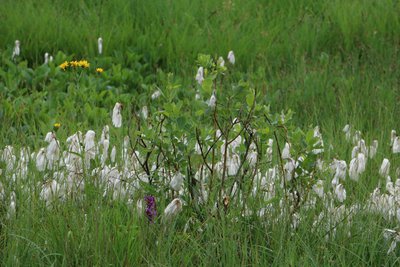
linaigrettes (CEN Franche-Comté / C.Lapprand) - CEN Franche-Comté / C.Lapprand Natural environmentsThe low marsh
This peculiar peat bog environment can be seen from the path to the Petit Maclu. The few trees and bushes able to grow in these difficult conditions (waterlogged soil, lack of oxygen, etc.) are birches, willows and alder buckthorn. In the spring, the white cotton grass bobbles - a plant typically found in these environments - can be seen above the grass.
The lake used to be bigger. Little by little, aquatic plants have grown, and the permanently humid conditions have not allowed dead vegetation to decompose. By building up, all of these plants have formed what is called peat. In this peat bog, the peat isn’t very thick, but in the peat bog between the Grand Maclu lake and the Ilay lake, it has reached over 1.5m.
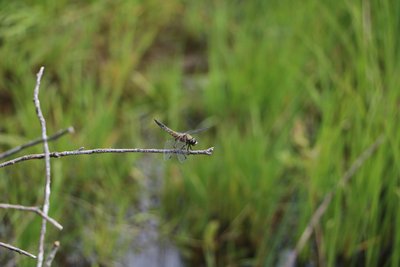
Libellule à quatre taches (CEN Franche-Comté / C.Lapprand) - CEN Franche-Comté / C.Lapprand FaunaDragonflies
These diverse wetlands attract many species of insects, including dragonflies. Over half of the species in mainland France are located around ponds, lakes, rivulets and smaller pools on the site.
The four-spotted chaser is easily recognisable with its very visible dots on the middle of each of its four wings. Adults of this large dragonfly species can be seen from May to September. Its wing can measure up to 4 cm long!
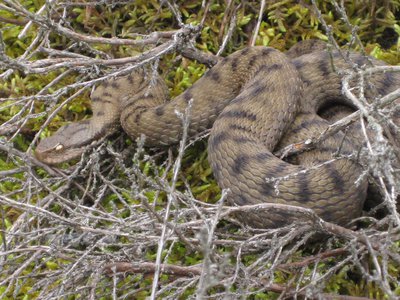
Vipère aspic (CEN Franche-Comté / S.Moncorgé) - CEN Franche-Comté / S.Moncorgé FaunaThe asp viper
Widely present in the marsh area between the Petit Maclu and the Grand Maclu, the asp viper is a poor swimmer and seeks sunny areas to ensure its metabolism can function properly. Like many reptiles, it is fearful and has a talent for detecting vibrations. To avoid bothering this species and being bitten, stamp your feet and be careful not to squash it, it will hide well before you even see it!
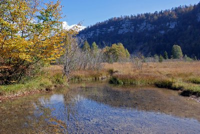
Eentre Maclu et Ilay (OT Haut-Jura Grandvaux / ® B. Leroy ) - OT Haut-Jura Grandvaux / ® B. Leroy Lakes & RiversNatural lakes, a fragile heritage
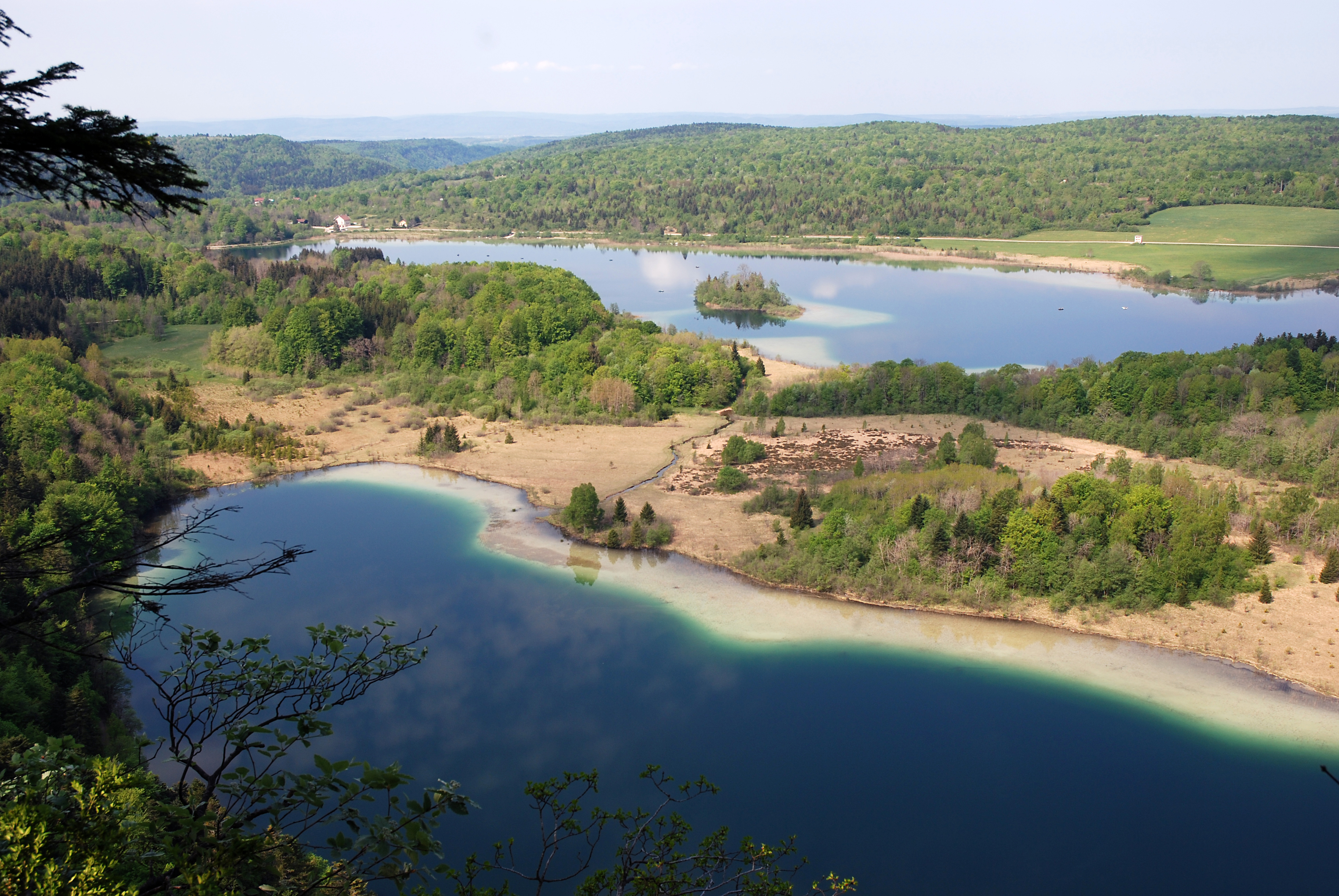
The waters of the Petit Maclu and the Grand Maclu feed the lake of Ilay. Each occupies a shallow basin dug out by the glaciers around 20,000 years ago.
These lakes are mainly surrounded by a wide diversity of vegetation, called low-marshes, wet tall-herb and fern fringes or peat bogs. Some reed beds also develop there. Insects flourish here due to the high quality of the environment, in particular dragonflies who vary in colour. The Eurasian coot is the most faithful bird to these lakes. Not very discreet, it is recognisable by its trumpeting cries of warning.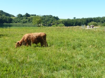
Vache highland cattle (CEN Franche-Comté/ S.Moncorgé) - CEN franche-Comté / S.Moncorgé Natural environmentsA natural managed site
The Franche-Comté conservatory for natural areas manages the wetlands on the 4 lakes site in partnership with the owning municipalities and local farmers. This site is fill of species specific to open environments which must be preserved.
Once used by farmers, these zones have gradually been abandoned. This is why managers have made maintaining this type of environment a priority by reinstating extensive grazing.
Highland Cattle cows are able to move around on waterlogged soil and find the food that they need. The amount of cattle and grazing periods are adapted depending on the species and environments in question.
A site sheet dedicated to the wetlands on the 4 lakes site is available online:
http://cen-franchecomte.org/document.php?iddoc=63DyRcgMw7YQ42PG
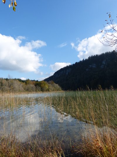
Lac d'Ilay (PNRHJ / Gilles Prost) - PNRHJ / Gilles Prost History & HeritageThe island of La Motte
Centred between the banks of the lake of Ilay is an island: the island of La Motte. Archaeological excavations have revealed that is was home to three successive religious establishments. An initial church was erected around the year 1,000 and seems to have burned down. After being rebuilt, a vestibule was added to it by a monastic congregation that ended up abandoning the place. Of the third establishment, we know only that it was abandoned during the 15th century. A wooden bridge provided access to the structure from the bank and the marshes that are now present were once orchards and pastures.
Lac de Narlay - OT GRANDVAUX Lakes & RiversNarlay lake
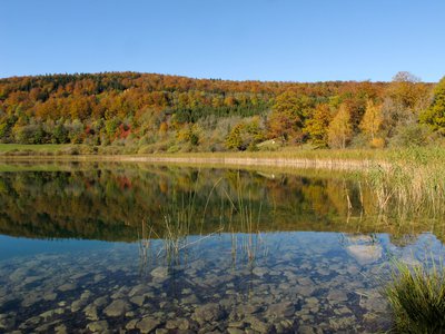
Surrounded by two forest massifs, Sur les Agrailles to the north and Mont des Ifs to the east, Narlay lake resembles a large 40-metre-deep funnel, making it the deepest natural lake in the Jura.
Fed by a series of small emergences, its waters disappear into an underground outlet and feed the Chalain lake 7.5 km away as the crow flies.
Description
From the parking lot, carefully cross the D 75 (yellow waymarking) and head to the Monts des Ifs intersection.
Follow the path to the left below the road and reach the top of the LAC DU PETIT MACLU (Petit Maclu Lake).
Take the good stony path along the lakes, heading past the Petit Maclu and the Grand Maclu, and after a small forest section, arrive at the edge of the Lac d’Ilay before joining up with the Chemin des lacs.
Continue on the path to your right (white and red waymarking) until you reach Lac d’Ilay.
(If you would like to shorten this circuit and only take the trip around the three lakes, branch off to the right and take the Chemin des Bornes, followed by the Mont des Ifs.)
From the Lac d’Ilay intersection, carefully cross the D 75 and follow a tree-lined path towards the hamlet of LA FROMAGERIE.
Turn right (yellow waymarking) onto a long wooded path bordered by hedges, which heads to Le Raffour and then right to the village LE FRASNOIS.
Turn left. Chemin de la Vierge heads along the back of the village and meets up with the D 75 to the right. Take the road to your left, head past the church and the town hall and take the road towards Lac de Narlay.
At the Vers Narlay intersection, continue on the road to your left, and head towards the houses at the bottom of the hamlet. Follow the stony path that heads up and along the left of the lake. The path will take you up to the Monts des Ifs parking lot.
- Departure : Monts des Ifs parking lot
- Arrival : Monts des Ifs parking lot
- Towns crossed : Le Frasnois, La Chaux-Du-Dombief, and Chatelneuf
Forecast
Sensitive areas
- Impacted practices:
- Aquatic,
- Sensitivity periods:
- JanFebMarAprMayJunJulAugSepOctNovDec
- Contact:
- Parc naturel régional du Haut-Jura
29 Le Village
39310 Lajoux
03 84 34 12 30
www.parc-haut-jura.fr/
- Impacted practices:
- Aerial, Aquatic, Amenities, Underground, Land-based
- Sensitivity periods:
- AprMayJunJulAugSep
- Contact:
- Parc naturel régional du Haut-Jura
29 Le Village
39310 Lajoux
03 84 34 12 30
www.parc-haut-jura.fr/
Recommandations
Be careful when crossing roads, particularly at the departure point to reach the Mont des Ifs intersection and at the D 75 at Lac d’Ilay.
The wetlands around the lakes are preserved and fragile natural areas. Please do not leave the waymarked paths and respect the tranquillity of this site.
Cows and horses maintain these areas around the 4 lakes and are moved from plot to plot throughout the season. These animals are hardy: please do not attempt to approach them or feed them, you could harm their health and put yourself in danger.
Wild flowers are beautiful, they may be rare and protected and often wilt quickly. Do not pick them! They will delight the next hikers.
Please keep your dog on a lead if you have one.
Information desks
Tourist information centre - Haut-Jura Grandvaux
7 place Simone Veil, 39150 Saint-Laurent-en-Grandvaux
Tourist information centre - Jura Monts Rivières
28 rue Baronne Delort, 39300 Champagnole
Tourist information centre - Pays des Lacs et Petite Montagne
36 Grande Rue, 39130 Clairvaux-les-lacs
Transport
To visit and get about in the High-Jura, visit www.reshaut-jura.fr, the eco-mobility portal listing all means of transport within the Park.
Access and parking
14 km from Saint-Laurent-en-Grandvaux via the N 5 towards Champagnole until Pont de la Chaux (municipality of Chaux-des-Crotenay), then take the D 75 towards Frasnois. The Monts des Ifs parking lot is on your right, 500 metres after the Petit Maclu lake parking lot.
Parking :
Report a problem or an error
If you have found an error on this page or if you have noticed any problems during your hike, please report them to us here:
Close by1
Laid-out site
Belvedere of the Pic de l’Aigle (Eagle’s peak)
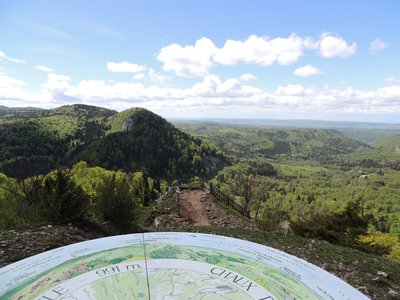
On the windy top of the Pic de l’Aigle, the landscape is yours to admire. To the west, the two main plateaus that mark the start of the Jura’s relief stretch out before you. The rocky ledge where the Pic de l’Aigle culminates and the lake region mark a break with the relief’s third plateau which is located to the east and gives way to the folded structures of the Jura’s high valleys.

