The Crossing of Corridors
“What if we took a little time to rediscover our link to nature? Let’s take the time to see what is around us. Few things are needed to find serenity once more: the singing of birds, the smell of the undergrowth, the texture of bark, the colours of dead leaves. Discovering the wilderness is within everyone’s reach. But during a time when things are happening ever faster, let us take the opposite approach [...]” Julien Arbez, photographer and nature guide (High-Jura)
5 points of interest
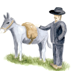
Ulysse et son mulet - PNRHJ Pastoralism and agriculture“In the footsteps of Ulysse” discovery trail
From the village of Les Bouchoux to the Dalloz mill waterfall, this trail takes you on a discovery of the peasant’s world of old. It tells the story of Ulysse, a peaceful man that enjoys life from his mill, on the edge of the Tacon, above the waterfall. He will help you on your journey with Flocon, his mule, by his side.
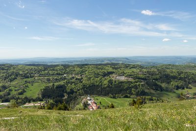
Vue depuis la croix des couloirs - PNRHJ / Nina Verjus ViewpointViewpoint from the crossing of corridors
For some, the crossing of corridors symbolises a link between the village of Les Bouchoux and that of La Pesse, which was once part of the municipality of Les Bouchoux.
From this viewpoint, the eye is drawn to the Jura Mountains to the east, and to the village of Les Bouchoux to the west. It is built on a moraine that is perpendicular to the Tacon combe - a strategic position to gain extra sunlight.
This site’s position, as if encased by the valley, seems to contribute towards the village square's exceptional acoustic properties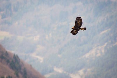
Aigle royal en vol - PNRHJ / Léo Poudré FaunaThe golden eagle
A large legendary bird of prey, since the 2000s, the golden eagle can once more be seen in the Jura skies. Initially restricted to the National Natural Reserve of the High-Jura mountain range, its territory is slowly expanding towards the west and the north.
It has an impressive wingspan that can reach over 2 metres wide, 1.5 times wider than that of a buzzard. Its rectangular wings, with finger-like ends help to identify it when you know what to look for.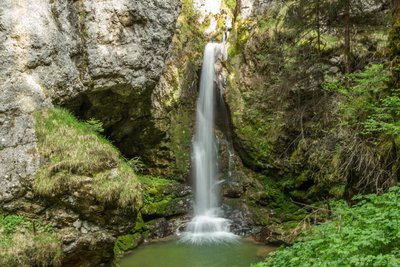
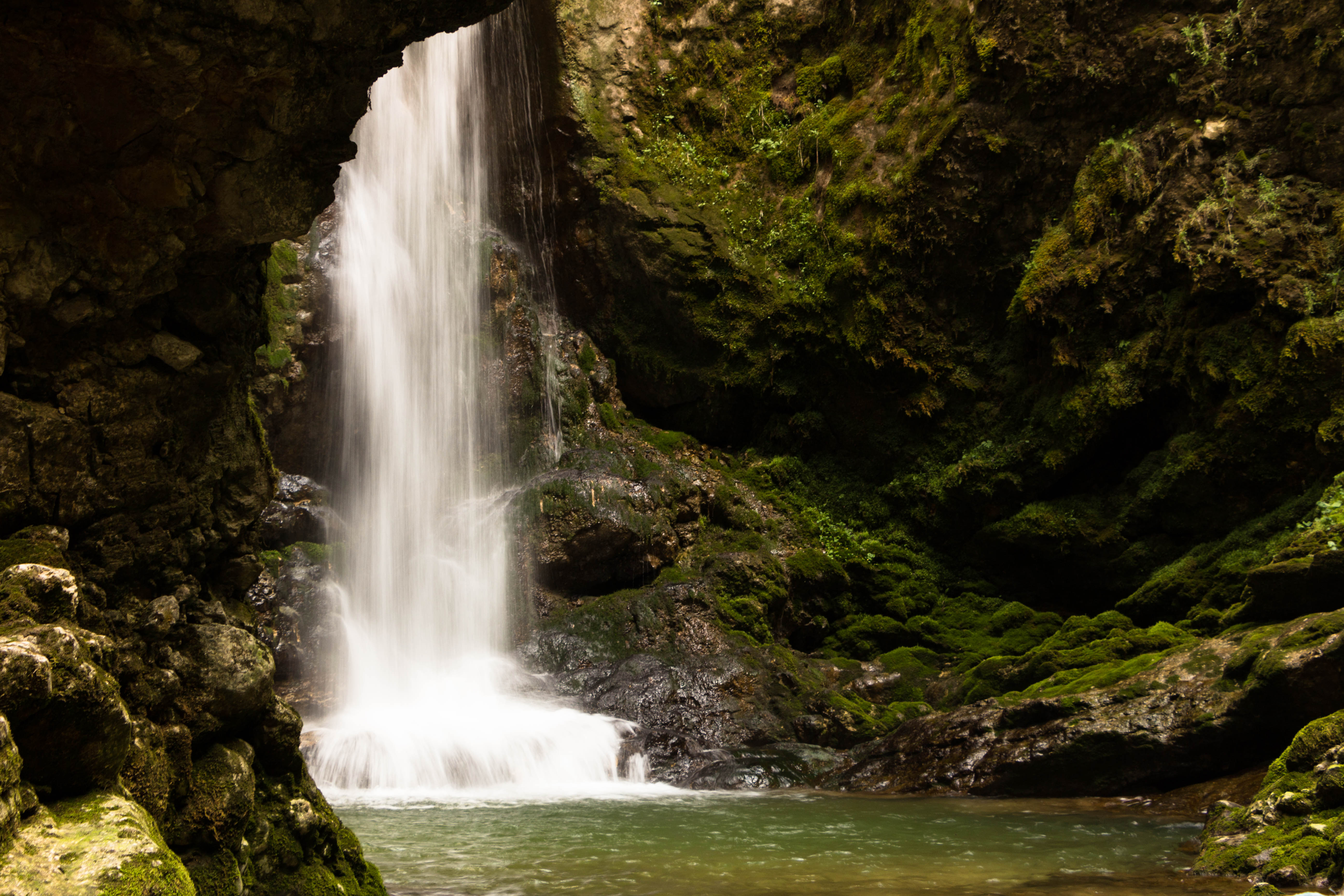
Cascade du moulin d'Aval - PNRHJ / Nina Verjus WaterfallsThe Moulin d’Aval Waterfall
Here, the Tacon rushes over a limestone barrier, cascading into an intimate rocky cirque. This hydraulic site once served to operate a mill just upstream from the waterfall which no longer exists. The site of the Moulin d’Aval waterfall (or the Dalloz mill) has been listed in the landscape inventory since 1961.
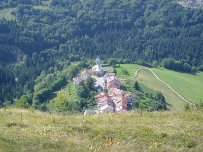
Place de l'église - PNRHJ / Julien Barlet Acoustic siteAcoustic site of the village square in Les Bouchoux
At the heart of the Tacon valley, on an advanced headland, the village square in Les Bouchoux is a high-quality little acoustic speaker, boxed in by the church, the town hall and the surrounding houses. The square’s configuration means that it is capable of accommodating cultural events that require almost no amplifiers, allowing for an intimate atmosphere.
Description
From LES BOUCHOUX, the hike starting point, at the foot of the village near the bar and the grocery, the trail (yellow and red waymarking) ascends the small road to the right, parallel to the D 25 E1, until it reaches Bonneville.
The “chemin des Couloirs” ascends to the right and heads past a reservoir. After a stable; climb up a narrow trail to reach the forest. The path opens on to a rocky ridge (be caureful!). Follow the ridge line until you reach THE CROSSING OF CORRIDORS. Via the ridge, reach the Guichard Corridor (former ski humping hill).
Head north (yellow waymarking) and reach the D 25 at la Crochère through pastures and wooded meadows. Follow the road to the left, and come to Sur l’Enversy via a grassy trail. The trail heads along a barrier and joins up with a stone path (quarry below the la Crochère cliffs). After a bend, reach the road at l’Enversy. The road descends to the right until it comes to the intersection at Le Prieuré.
Continue on a path to your left and head past the hamlet of Prioré.
Descend through a forest trail (tuffaceous concretion). After a short ascent, through a pasture, head between two houses to reach Les Petits-Bouchoux to the right.
Head down a road to your right for 150 m. Branch off once more to the right to follow a path along the right embankment of the Tacon. Cross the torrent (bridge), and head up a trail to Moulin d’Aval for 100 m. Descend to the foot of the MOULIN WATERFALL, using the adapted trail. Head back the same way you came.
From Les Petits Bouchoux, the road to the left, followed by a road suitable for vehicles, will lead you back up to the village of Les Bouchoux, leaving a Little Combe behind you to your left.
Cut across the square and through the village to return to your starting point.
- Departure : Village square - Les Bouchoux
- Arrival : Village square - Les Bouchoux
- Towns crossed : Les Bouchoux and La Pesse
Forecast
Altimetric profile
Recommandations
Be careful when ascending to steep slope up to The Crossing of Corridors, and when crossing the D 25 at La Crochère.
This trail passes through private property pastures with livestock and forest paths. To respect the owners and farmers granting you passage, and for the security of livestock and wild fauna, we ask that you remain on the waymarked paths. Use the adapted passageways to get across fencing and be sure to close gateways behind you.
Please keep your dog on a lead if you have one.
Wild flowers are beautiful, they may be rare and protected and often wilt quickly. Do not pick them! They will delight the next hikers.
In case of forest works (felling, skidding, etc.), for your safety, know when to stop and turn around.
Information desks
Tourist information centre - Haut-Jura Saint-Claude
3 place de l'Abbaye, 39200 Saint-Claude
Transport
To visit and get about in the High-Jura, visit www.reshaut-jura.fr, the eco-mobility portal listing all means of transport within the Park.
Access and parking
10 km south of Saint-Claude via the D 124 and the D 25 E1.
Parking :
Report a problem or an error
If you have found an error on this page or if you have noticed any problems during your hike, please report them to us here:
