La Dôle mountain
After an ascension through mountain pastures, its 360° panoramic view over France and Switzerland will reward your efforts. You may also have the privilege of witnessing - with all necessary safety precautions - the acrobatic movements of the Chamois goats on the cliffs or the dizzying dance of wallcreepers along the rock walls.
4 points of interest
Vallée des Dappes - Nina Verjus - PNRHJ History & HeritageStory of the Dappes valley
The Italian campaign of 1796-1797 showed Napoleon Bonaparte that there was a great need for very quick French communication between Paris and the Simplon Pass via Geneva. Negotiations with Switzerland resulted in the mapping of a route on French territory.
When the Empire fell in 1815, France’s borders were returned to those existing prior to 1790. However, both countries claimed to own the Dappes valley. In 1862, the dispute was resolved by the Treaty of Dappes. France was given the land on which the route de la Faucille had been mapped (now the N5) and in return, Switzerland was awarded the rest of the valley, as well as part of the Noirmont slope on the French side.
Thus, some of the La Cure homes which had always been French became Swiss. Some are still split in two by the border, with one foot in France and the other in Switzerland.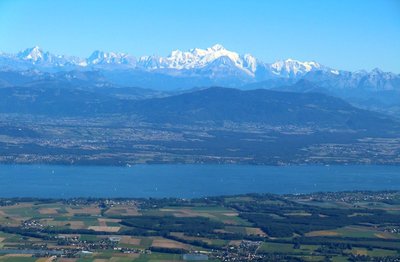
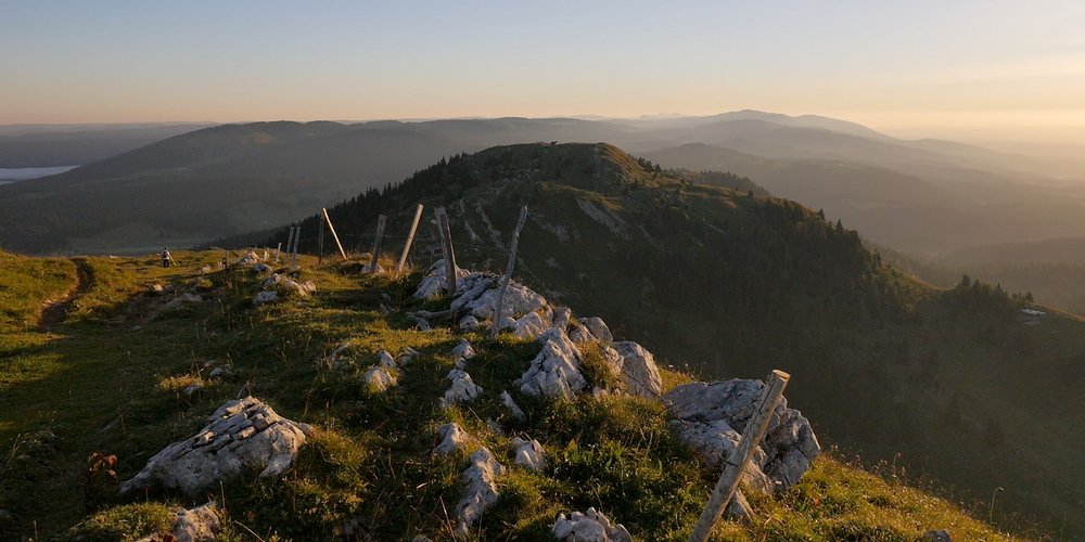
Point de vue au sommet de la Dôle - Gilles Prost - PNRHJ Peak – ViewpointViewpoint from the summit of the Dôle
On the Swiss side, the summit of the Dôle offers dizzying views over Lake Leman, Geneva, and in the distance, the Alps and the iconic Mont Blanc. From France, it provides a panorama of the village of Les Rousses, the valley of the Valserine and the Jura mountains. For the last few years, a viewing table has helped visitors to locate each summit of the alpine arc, from the Jungfrau to the Vanoise.
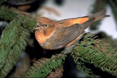
Bec croisé des sapins - Claude Nardin FaunaThe red crossbill
The red crossbill is a colourful species that lives mainly in small groups. This bird, which is nomadic to coniferous forests, settles in areas where spruces produce well, as its main source of food comes from the spruce seeds found in the centre of cones or pine-nuts.
To get to these seeds, this bird hangs upside down from the cone, inserts its beak under the cone’s leaves and opens its mandibles to separate them, retrieving the seeds with its tongue. The bird starts at the bottom of the cone and works its way upwards in a spiral fashion.
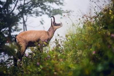
Chamois - Léo Poudré - PNRHJ FaunaThe Chamois: the mountain dromedary
The Chamois is able to quench its thirst by drawing water from the plants that it eats. But to absorb a sufficient amount of water, imagine just how many plants it must ingest! The Chamois’ diet is comprised of over 70 species of plants. In winter, when vegetation is sparse, it licks the snow for additional hydration.
Description
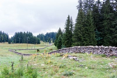
From LES DAPPES, the itinerary heads towards a small combe to the left and crosses a low stone wall: this is the Swiss border! A grassy path (yellow diamond waymarking) heads up to the right towards a ski lift before crossing a road at Couvaloup de Crans.
The stony path heads up to the right bordering a forest and opens onto a flat area with an open landscape overlooked by the Dôle pasture.
Take the trail to the left that heads downwards for a short stretch. Cross over a low stone wall and head up the pasture towards the Poêle Chaud Chalet (ski lift). Head up to the Col de Porte mountain pass taking a stony path (viewpoint).
To the right, the trail climbs up to the summit ridge (take care, follow the waymarked path attentively) to reach LA DOLE.
The trail descends to the south through the pasture, circumventing the abrupt slope of the ridge. After a few steep and rocky slopes, the trail reaches the dip in the cirque (drinking trough) before heading north towards la Dôle chalet.
Head left up an increasingly steep slope to reach the Porte pass.
Return to LES DAPPES the way you came.
- Departure : Les Dappes, at the foot of la Dôle
- Arrival : Les Dappes, at the foot of la Dôle
- Towns crossed : Premanon
Forecast
Altimetric profile
Recommandations
Be careful on the edge of the ridge during foggy weather.
This trail passes through pastures with livestock and forest paths. To respect the owners and farmers granting you passage, and for the security of livestock and wild fauna, we ask that you remain on the waymarked paths. Use the adapted passageways to get across fencing and be sure to close gateways behind you. Please keep your dog on a lead if you have one.
Wild flowers are beautiful, they may be rare and protected and often wilt quickly. Do not pick them! They will delight the next hikers.
In case of forest works (felling, skidding, etc.), for your safety, know when to stop and turn around.
Lastly, after a few meters in France, this trail is mainly located on Swiss territory; be sure to take your ID with you.
Information desks

Tourist information centre - Station Les Rousses Haut-Jura
495 rue Pasteur Maison du Tourisme, 39220 Les Rousses
Transport
To visit and get about in the High-Jura, visit www.reshaut-jura.fr, the eco-mobility portal listing all means of transport within the Park.
Access and parking
6 km southeast of Les Rousses via the N5, along the col de la Faucille road.
Parking :
Report a problem or an error
If you have found an error on this page or if you have noticed any problems during your hike, please report them to us here: